CityScope · Planning Updates
Application ABS/APP/2025/1384
Land To West Of A96 Between Thainstone And Port Elphinstone Roundabouts (B993) LDP Allocated Sites OP5, OP6 And The Northernmost Parcel SR1 Crichie Inverurie
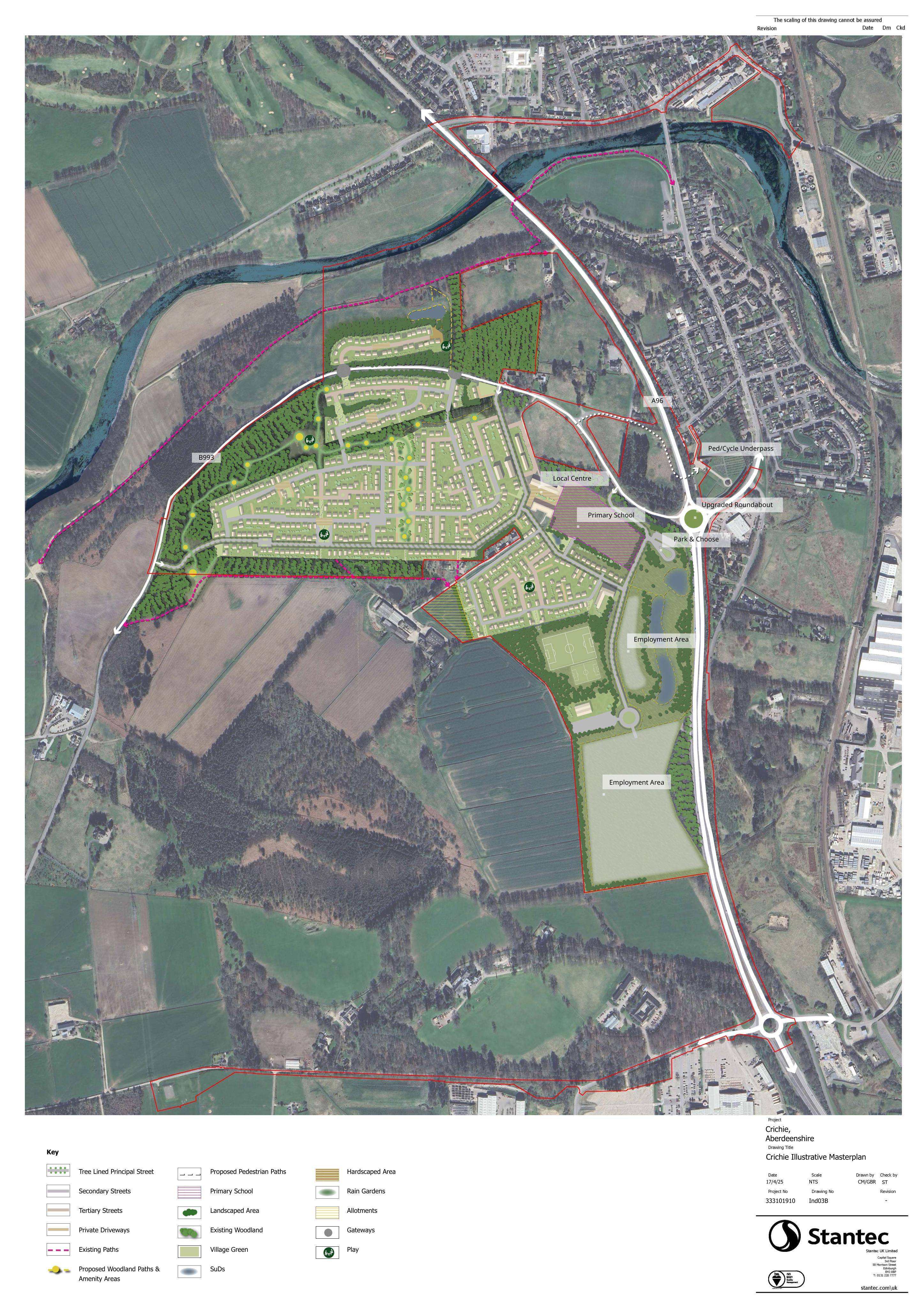
Residential-led mixed-use masterplan with employment land, local centre and primary school, plus new roads, parking, open space and strategic earthworks.
The record
- Reference
- ABS/APP/2025/1384
- Address
- Land To West Of A96 Between Thainstone And Port Elphinstone Roundabouts (B993) LDP Allocated Sites OP5, OP6 And The Northernmost Parcel SR1 Crichie Inverurie
- Status
- Awaiting decision
- Category
- New-Build & Major Development
- Impact scale
- 8/10
- Authority
- Aberdeenshire Council
Timeline
- Received
- Validated
- Last scraped
- Record created
Additional application data
- Latitude
- 57.2665
- Longitude
- -2.3757
What is proposed
Plain-language summary
Residential-led mixed-use masterplan with employment land, local centre and primary school, plus new roads, parking, open space and strategic earthworks.
As filed with the council
Erection of Residential Led Mixed Use Development Including Employment Land, Local Centre and Land for Primary School with Associated Infrastructure (Including Roads, Parking, Landscaping, Open Spaces & Nature Trails, Play Spaces, Allotments, Community Facilities/Sports Pitches, Park and Choose Facility and SuDS) and Full Permission for Strategic Earthworks, Platforming and Infrastructure Delivery