CityScope · Planning Updates
Application DGY/25/1616/FUL
Whinbank Stoneykirk Stranraer DG9 9DZ
DecidedLandscaping, Gardens & BoundariesReceived Dumfries and Galloway Council
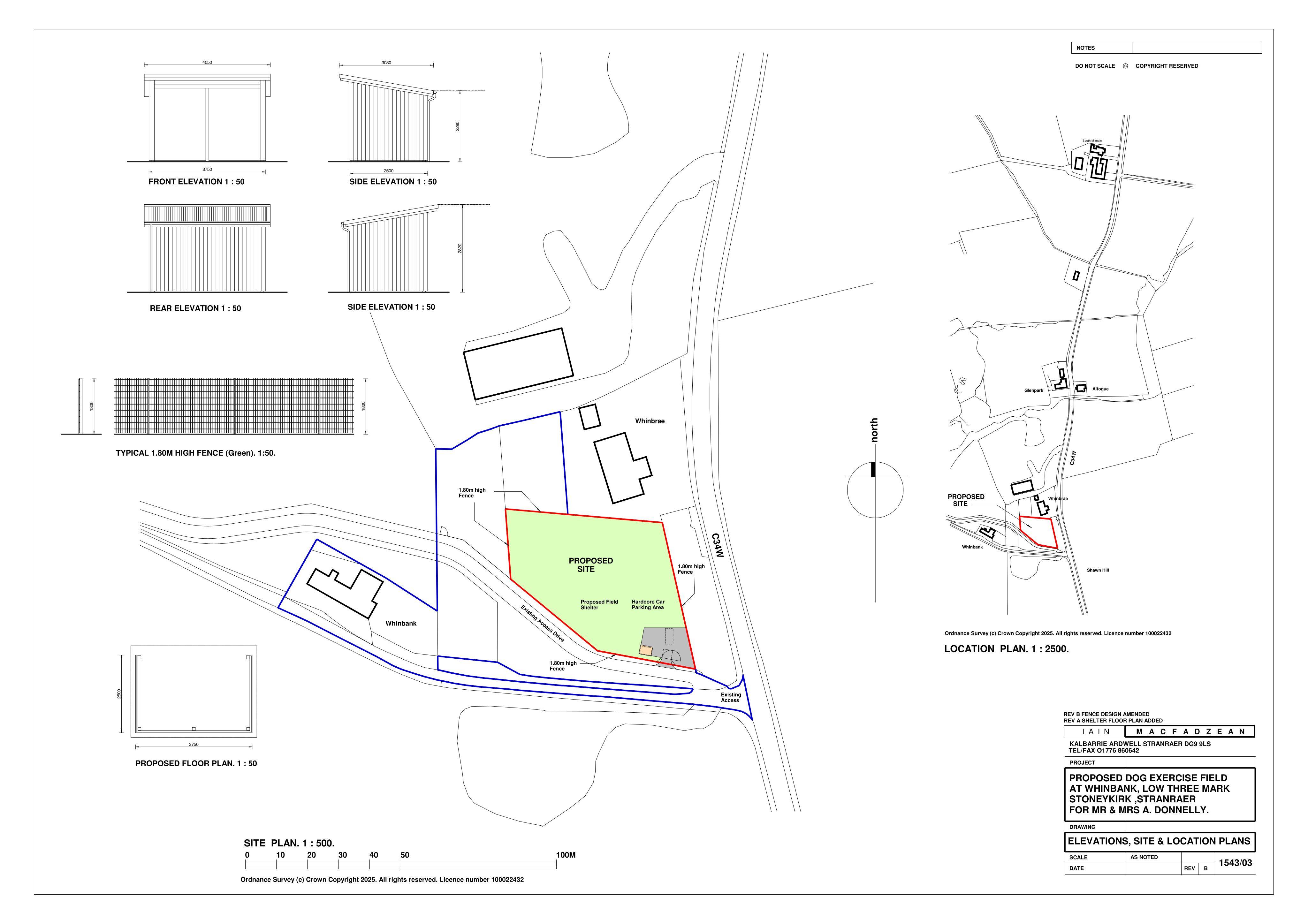
Change of agricultural land to a dog exercise area with field shelter, boundary fence, and car parking.
The record
- Reference
- DGY/25/1616/FUL
- Address
- Whinbank Stoneykirk Stranraer DG9 9DZ
- Status
- Decided
- Category
- Landscaping, Gardens & Boundaries
- Impact scale
- 4/10
- Authority
- Dumfries and Galloway Council
Timeline
- Received
- Validated
- Last scraped
- Record created
Additional application data
- Latitude
- 54.8221
- Longitude
- -4.9784
What is proposed
Plain-language summary
Change of agricultural land to a dog exercise area with field shelter, boundary fence, and car parking.
As filed with the council
CHANGE OF USE OF AGRICULTURAL LAND TO FORM DOG EXERCISE AREA, ERECTION OF FIELD SHELTER AND 1.8 METRE HIGH BOUNDARY FENCE AND FORMATION OF CAR PARKING AREA AND ASSOCIATED WORKS