CityScope · Planning Updates
Application DGY/26/0048/FUL
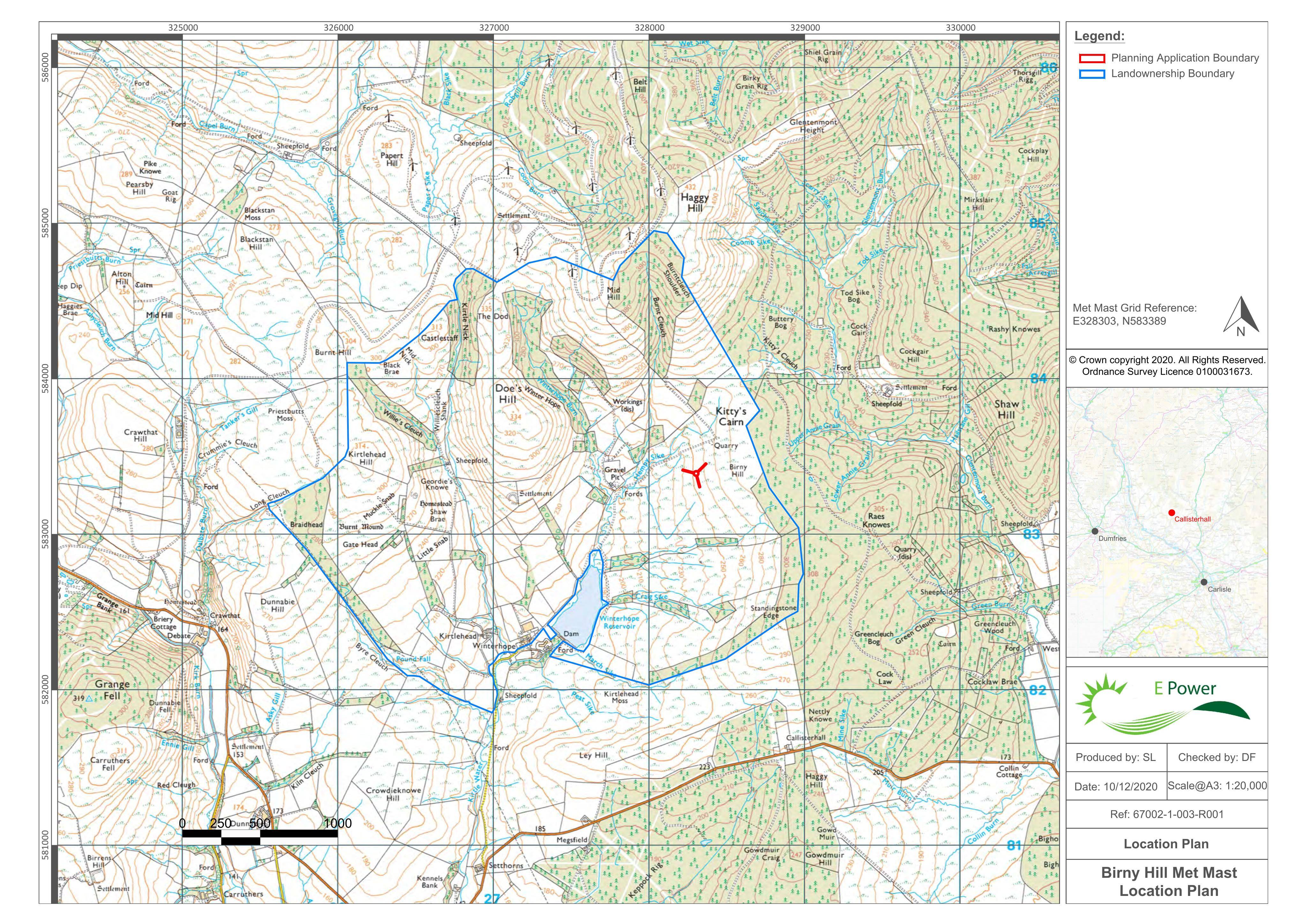
Land West Of Birny Hill Above Winterhope Reservoir 7.5km To The West Of Langholm
DecidedTelecommunicationsReceived Dumfries and Galloway Council
Retrospective plan for a temporary 100m meteorological mast for five years, with a defined construction/working area at Birny Hill.
The record
- Reference
- DGY/26/0048/FUL
- Address
- Land West Of Birny Hill Above Winterhope Reservoir 7.5km To The West Of Langholm
- Status
- Decided
- Category
- Telecommunications
- Impact scale
- 6/10
- Authority
- Dumfries and Galloway Council
Timeline
- Received
- Validated
- Last scraped
- Record created
Additional application data
- Latitude
- 55.1396
- Longitude
- -3.1261
What is proposed
Plain-language summary
Retrospective plan for a temporary 100m meteorological mast for five years, with a defined construction/working area at Birny Hill.
As filed with the council
ERECTION OF METEOROLOGICAL MAST (MAXMIMUM HEIGHT OF 100 METRES) FOR A TEMPORARY PERIOD OF FIVE YEARS (RETROSPECTIVE)