CityScope · Planning Updates
Application DGY/26/1761/FUL
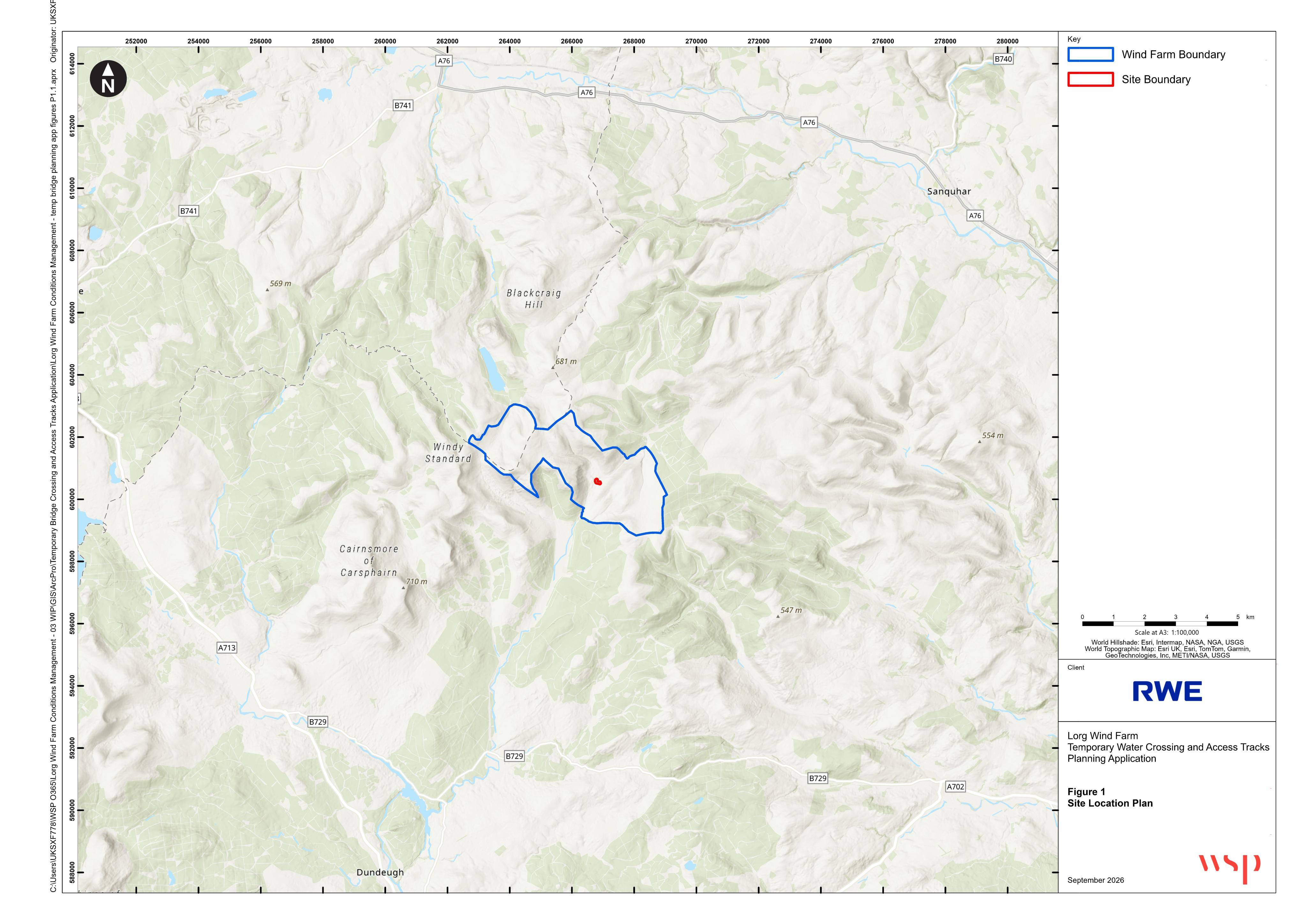
Within the Lorg Wind Farm site located between Carsphairn (located approximately 11km to the south west) and Sanquhar (located approximately 12.3km to the north east).
Assessment StageParking, Access & HighwaysReceived Dumfries and Galloway Council
Formation of access track with temporary water crossing linking existing road to consented development infrastructure.
The record
- Reference
- DGY/26/1761/FUL
- Address
- Within the Lorg Wind Farm site located between Carsphairn (located approximately 11km to the south west) and Sanquhar (located approximately 12.3km to the north east).
- Status
- Assessment Stage
- Category
- Parking, Access & Highways
- Impact scale
- 4/10
- Authority
- Dumfries and Galloway Council
Timeline
- Received
- Validated
- Last scraped
- Record created
Additional application data
- Latitude
- 55.211699
- Longitude
- -4.259969
What is proposed
Plain-language summary
Formation of access track with temporary water crossing linking existing road to consented development infrastructure.
As filed with the council
FORMATION OF ACCESS TRACK INCORPORATING A TEMPORARY WATER CROSSING TO PROVIDE A TEMPORARY LINK BETWEEN THE EXISTING ROAD AND THE CONSENTED DEVELOPMENT INFRASTRUCTURE