
CityScope · Planning Updates
Application FIF/25/01404/NMV1
Land To The South Of Hall Street Lochgelly Fife
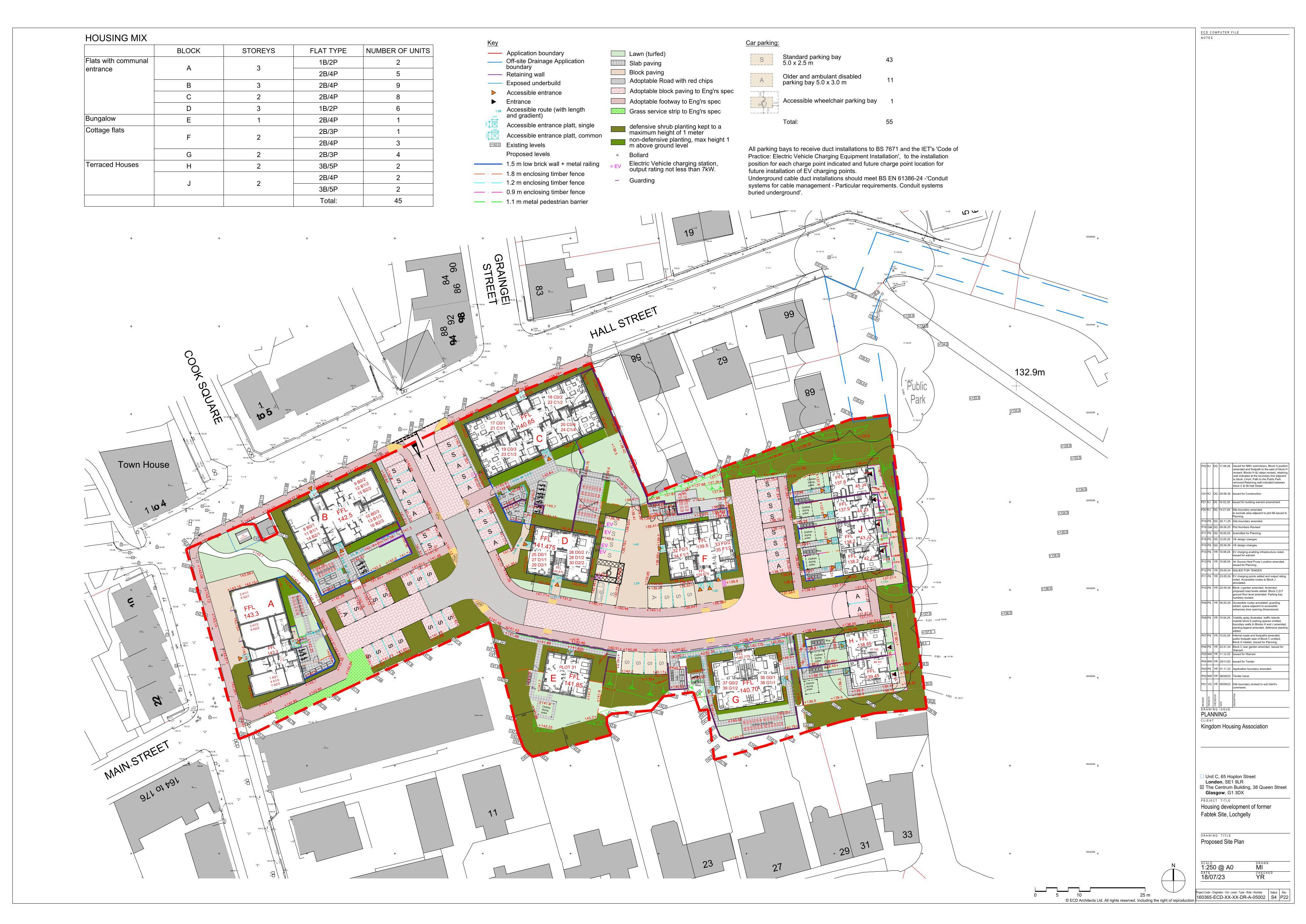
Proposed non-material variation to housing plans, revising the position of Block H, paths, steps and retaining walls.
The record
- Reference
- FIF/25/01404/NMV1
- Address
- Land To The South Of Hall Street Lochgelly Fife
- Status
- Registered
- Category
- Legal / Administrative
- Impact scale
- 3/10
- Authority
- Fife Council
Timeline
- Received
- Validated
- Last scraped
- Record created
Additional application data
- Latitude
- 56.1271
- Longitude
- -3.3059
What is proposed
Plain-language summary
Proposed non-material variation to housing plans, revising the position of Block H, paths, steps and retaining walls.
As filed with the council
Erection of 45 affordable dwellings comprising 7 dwellinghouses (Class 9), 38 flatted dwellings (Sui Generis) including 2.no ground floor retail units (Class 1A) with boundary enclosures and amenity storage, formation of new access road, footpaths and car parking, internal drainage, landscape and renewable technology infrastructure (Amendment to 23/02505/FULL including design changes, remix of units and omission of suds basin) (Non-Material Variation for Block H position amended, and the footpath to the east of Block H revised. Steps to Blocks H and J revised, with a retaining wall indicated along the boundary line adjacent to the front of Block J. Path and link to the Public Park removed. Retaining wall indicated between Block C and 58 Hall Street. to planning permission 25/01404/FULL)