
CityScope · Planning Updates
Application HLD/25/03113/PNO
Land 720M West Of Nevis Range Hotel Torlundy Fort William
DecidedParking, Access & HighwaysReceived The Highland Council
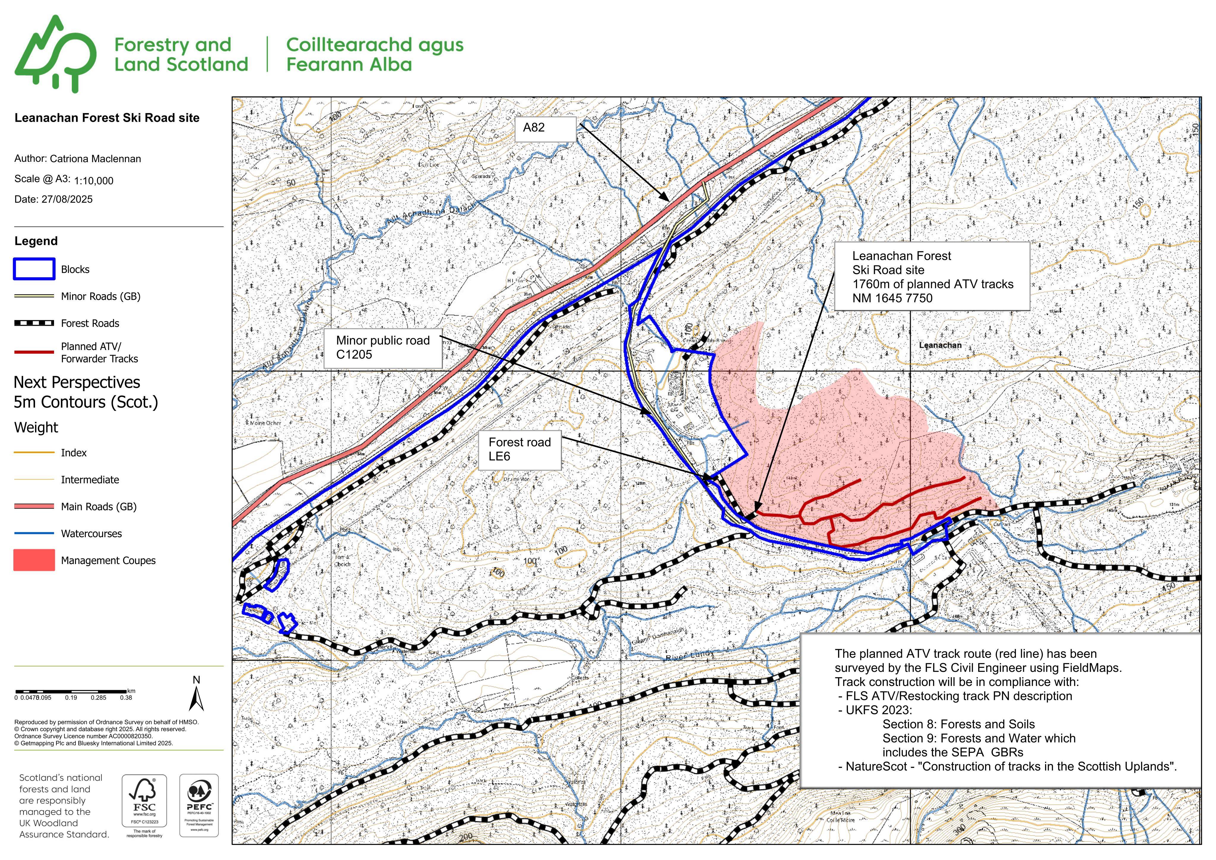
Proposed 2.5m-wide, 1.8km forest ATV track route for woodland and deer management, shown on submitted plans.
The record
- Reference
- HLD/25/03113/PNO
- Address
- Land 720M West Of Nevis Range Hotel Torlundy Fort William
- Status
- Decided
- Category
- Parking, Access & Highways
- Impact scale
- 6/10
- Authority
- The Highland Council
Timeline
- Received
- Validated
- Last scraped
- Record created
Additional application data
- Latitude
- 56.8527
- Longitude
- -5.0007
What is proposed
Plain-language summary
Proposed 2.5m-wide, 1.8km forest ATV track route for woodland and deer management, shown on submitted plans.
As filed with the council
Formation of forest ATV track (woodland and deer management; 2.5m wide; 1820m long)