CityScope · Planning Updates
Application HLD/25/03728/PAN
Land 1.4KM SW Of Inverlaidnan Carrbridge
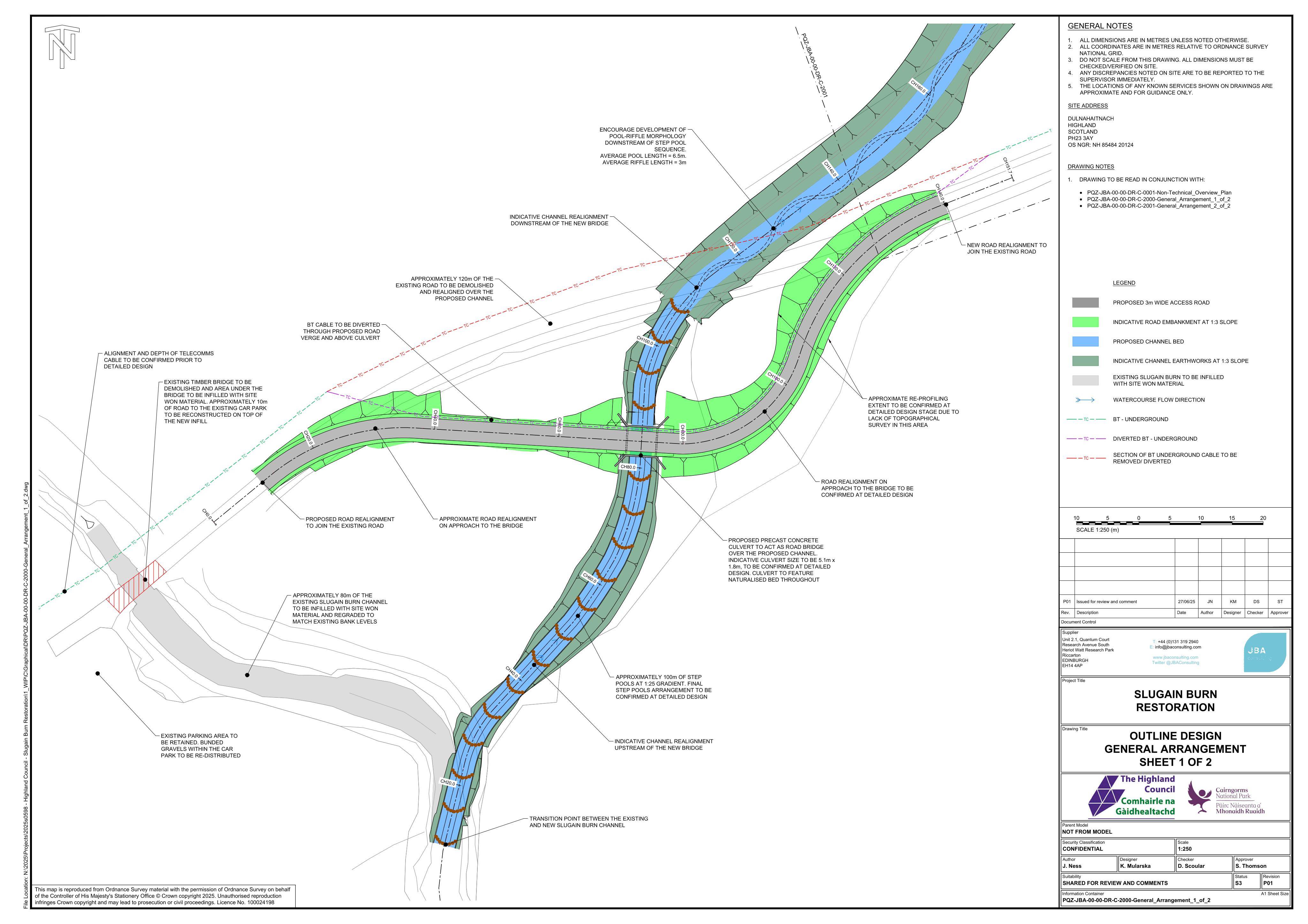
Realign c.1km Slugain/Sugain Burn and replace the Dalnahaitnach bridge with a flood-capable crossing, enhancing habitat and access.
The record
- Reference
- HLD/25/03728/PAN
- Address
- Land 1.4KM SW Of Inverlaidnan Carrbridge
- Status
- Unknown
- Category
- Trees, Ecology & Green Space
- Impact scale
- 6/10
- Authority
- The Highland Council
Timeline
- Received
- Validated
- Last scraped
- Record created
Additional application data
- Latitude
- 57.2571
- Longitude
- -3.8981
What is proposed
Plain-language summary
Realign c.1km Slugain/Sugain Burn and replace the Dalnahaitnach bridge with a flood-capable crossing, enhancing habitat and access.
As filed with the council
Slugain Burn Restoration project - The development aims to realign c.1km of the Sugain Burn, a tributary of the River Dulnain, along a more natural morphology & replace a vehicular bridge over the Slugain Burn at Dalnahaitnach with a new crossing that has the capacity to convey flood flows & sediment load in order to maintain access during storm events & reduce maintenance. The development will also deliver additional benefits including improved access for the local community, biodiversity & habitat quality whilst restoring natural river & floodplain processes.