CityScope · Planning Updates
Application HLD/25/04513/PAN
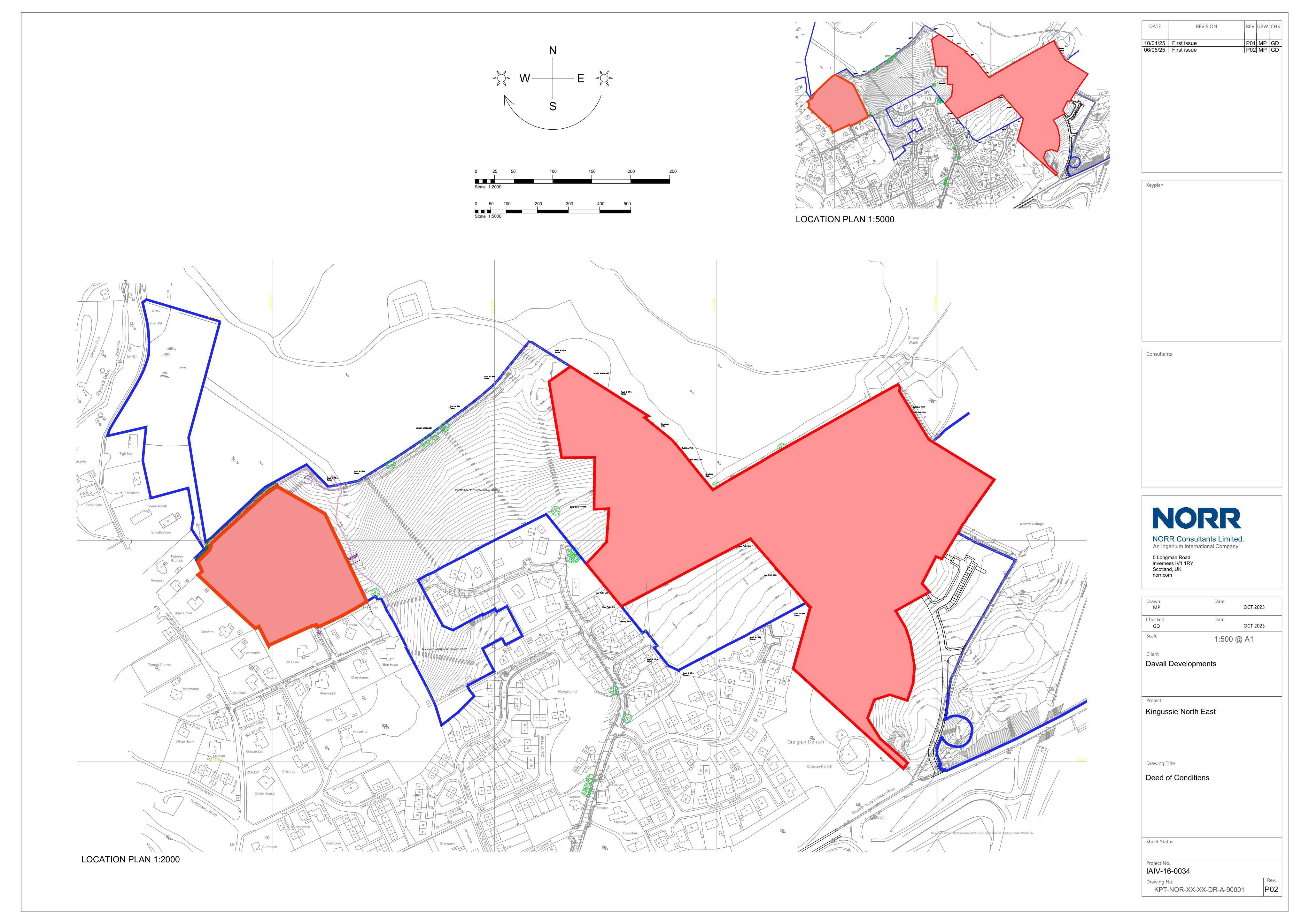
Land To North And East And West Of Dunbarry Terrace And Kerrow Drive Kingussie
UnknownNew-Build & Major DevelopmentReceived The Highland Council
Kingussie Phase 3: two housing sites creating new homes and infrastructure for around 116 dwellings/plots (108 at one site, 8 at another).
The record
- Reference
- HLD/25/04513/PAN
- Address
- Land To North And East And West Of Dunbarry Terrace And Kerrow Drive Kingussie
- Status
- Unknown
- Category
- New-Build & Major Development
- Impact scale
- 8/10
- Authority
- The Highland Council
Timeline
- Received
- Validated
- Last scraped
- Record created
Additional application data
- Latitude
- 57.0852
- Longitude
- -4.0517
What is proposed
Plain-language summary
Kingussie Phase 3: two housing sites creating new homes and infrastructure for around 116 dwellings/plots (108 at one site, 8 at another).
As filed with the council
Kingussie Phase 3 - Site A is 108 dwellings and associated infrastructure at land between Dunbarry Terrace and General Wades Military Road and site B is 8 residential plots and associated infrastructure at land adjacent to Ardbroilach Road