
CityScope · Planning Updates
Application HLD/25/04795/FUL
Land 225M West Of 107 Laid Loch Eriboll
DecidedParking, Access & HighwaysReceived The Highland Council
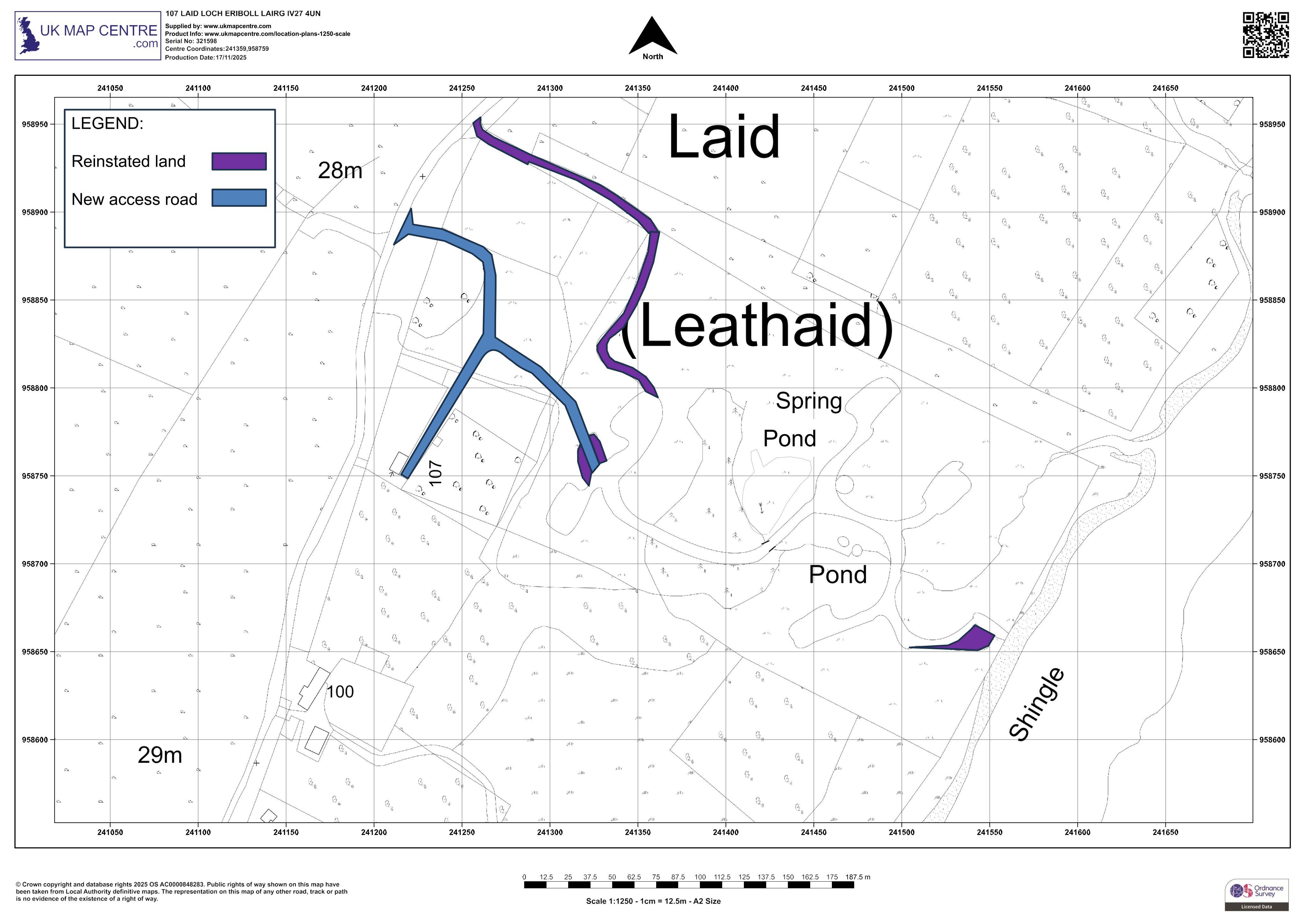
Proposed new access from the public road, with access tracks and hardstanding laid as retrospective works to the Leathaid site.
The record
- Reference
- HLD/25/04795/FUL
- Address
- Land 225M West Of 107 Laid Loch Eriboll
- Status
- Decided
- Category
- Parking, Access & Highways
- Impact scale
- 4/10
- Authority
- The Highland Council
Timeline
- Received
- Validated
- Last scraped
- Record created
Additional application data
- Latitude
- 58.4885
- Longitude
- -4.7209
What is proposed
Plain-language summary
Proposed new access from the public road, with access tracks and hardstanding laid as retrospective works to the Leathaid site.
As filed with the council
Construction of new access to public road. Formation of access tracks and hardstandings (retrospective)