
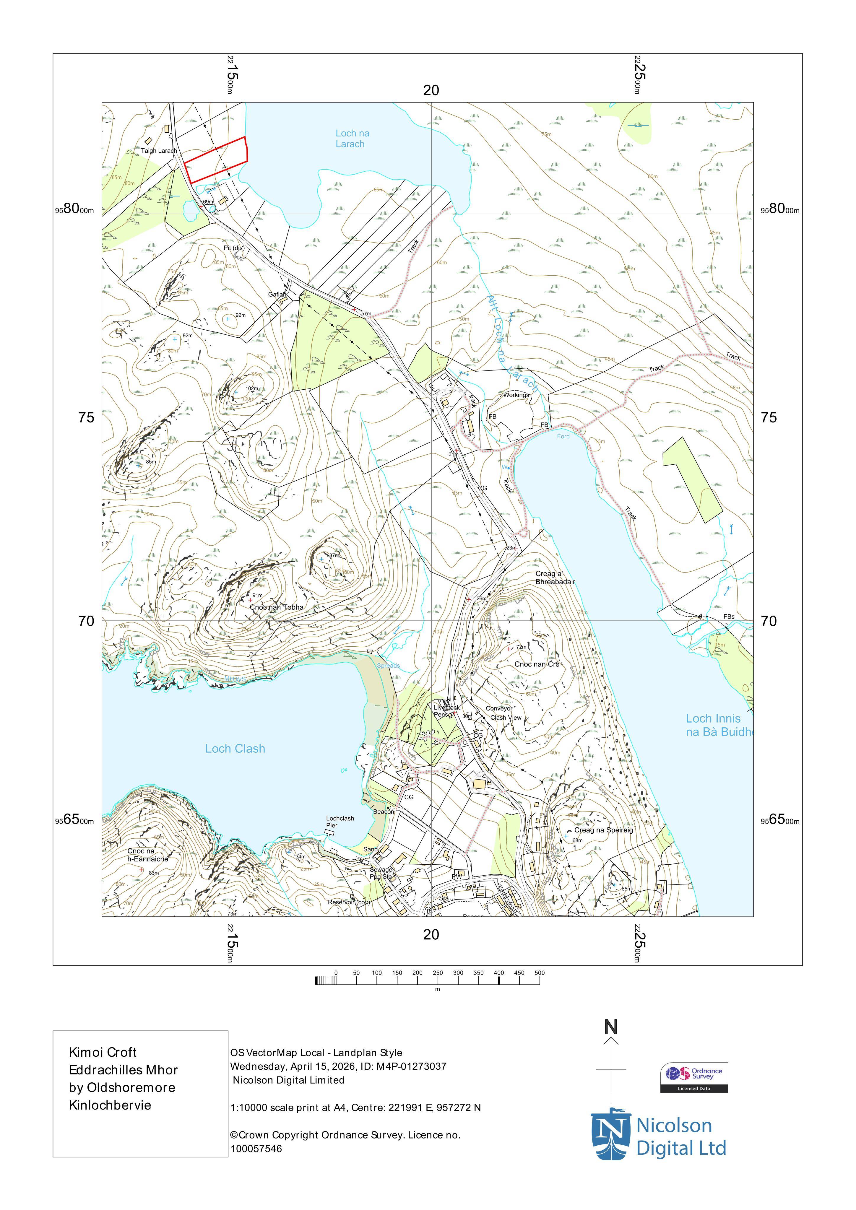
Planning applicationHLD/26/01439/FUL

Land 170M SE Of Taigh Larach Oldshoremore Rhiconich

Under ConsiderationParking, Access & Highways
Official records · coverage in progress

2,581 of 2,786 official records received 1 Sept 2025 – 31 Aug 2026 were available when checked on 6 Sept 2026. 205 records from that period are still being added or checked.

Proposals and decisions come from The Highland Council. Additional summaries and analysis are being added where verified.

Check the council’s planning register
Planning document
1 / 2
Received

6 April 2026

Validated

23 April 2026

Planning Signals

4 detected traits

Works
Hardstanding
Specific
Access ChangesAccess RoadsDrainage Wastewater Infrastructure
Application Insights

No form insights available yet.

AI summary

Proposed access track, hardstanding area and drainage to support improved vehicle access and manage surface water on site.

Impact scale

Estimated scale of impact on the surrounding area.

4/10
DISCUSSION

No comments yet

Be the first to share your local perspective on this application.

CityScope · Planning Updates

Application HLD/26/01439/FUL

Land 170M SE Of Taigh Larach Oldshoremore Rhiconich

Under ConsiderationParking, Access & HighwaysReceived The Highland Council

Proposed access track, hardstanding area and drainage to support improved vehicle access and manage surface water on site.

Reference
HLD/26/01439/FUL
Address
Land 170M SE Of Taigh Larach Oldshoremore Rhiconich
Status
Under Consideration
Category
Parking, Access & Highways
Impact scale
4/10
Authority
The Highland Council
Received
Validated
Last scraped
Record created
Latitude
58.4748
Longitude
-5.063

Plain-language summary

Proposed access track, hardstanding area and drainage to support improved vehicle access and manage surface water on site.

As filed with the council

Construction of access track, area of hardstanding and associated drainage