CityScope · Planning Updates
Application HLD/26/01827/FUL
Land 1.4KM SW Of Inverlaidnan Carrbridge
Awaiting decisionTrees, Ecology & Green SpaceReceived The Highland Council
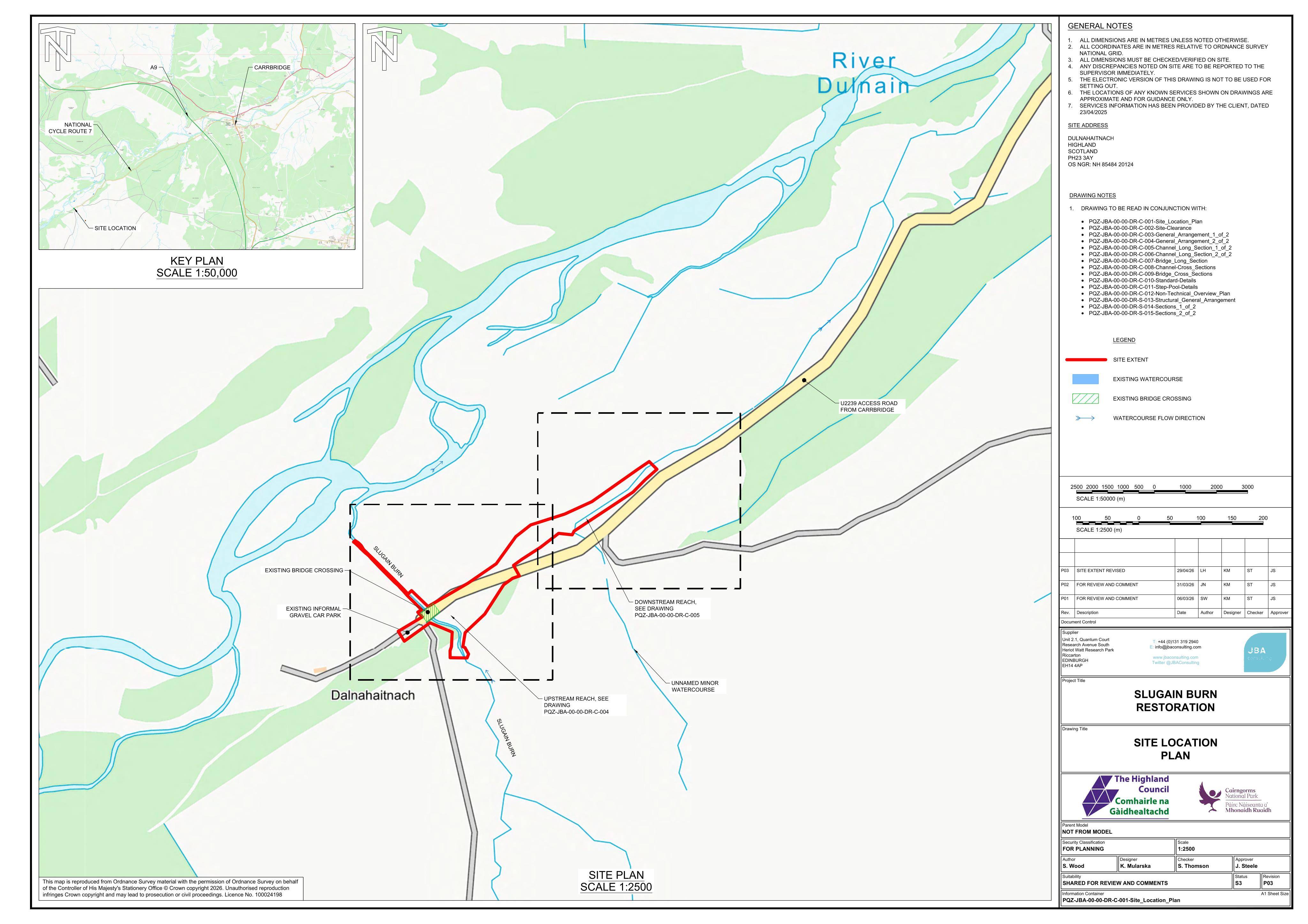
Proposed river channel and road realignment with a revised crossing, culvert installation, and habitat restoration at Slugain Burn.
The record
- Reference
- HLD/26/01827/FUL
- Address
- Land 1.4KM SW Of Inverlaidnan Carrbridge
- Status
- Awaiting decision
- Category
- Trees, Ecology & Green Space
- Impact scale
- 6/10
- Authority
- The Highland Council
Timeline
- Received
- Validated
- Last scraped
- Record created
Additional application data
- Latitude
- 57.2576
- Longitude
- -3.8967
What is proposed
Plain-language summary
Proposed river channel and road realignment with a revised crossing, culvert installation, and habitat restoration at Slugain Burn.
As filed with the council
Please visit, https://www.eplanningcnpa.co.uk/online-applications/#searchApplications Slugain Burn Restoration Project: River channel realignment, habitat restoration, road realignment, revised river crossing and installation of culvert