CityScope · Planning Updates
Application HLD/26/03906/PNO
Land 655M NE Of 12 Upper Inverroy Roy Bridge
Under ConsiderationLandscaping, Gardens & BoundariesReceived The Highland Council
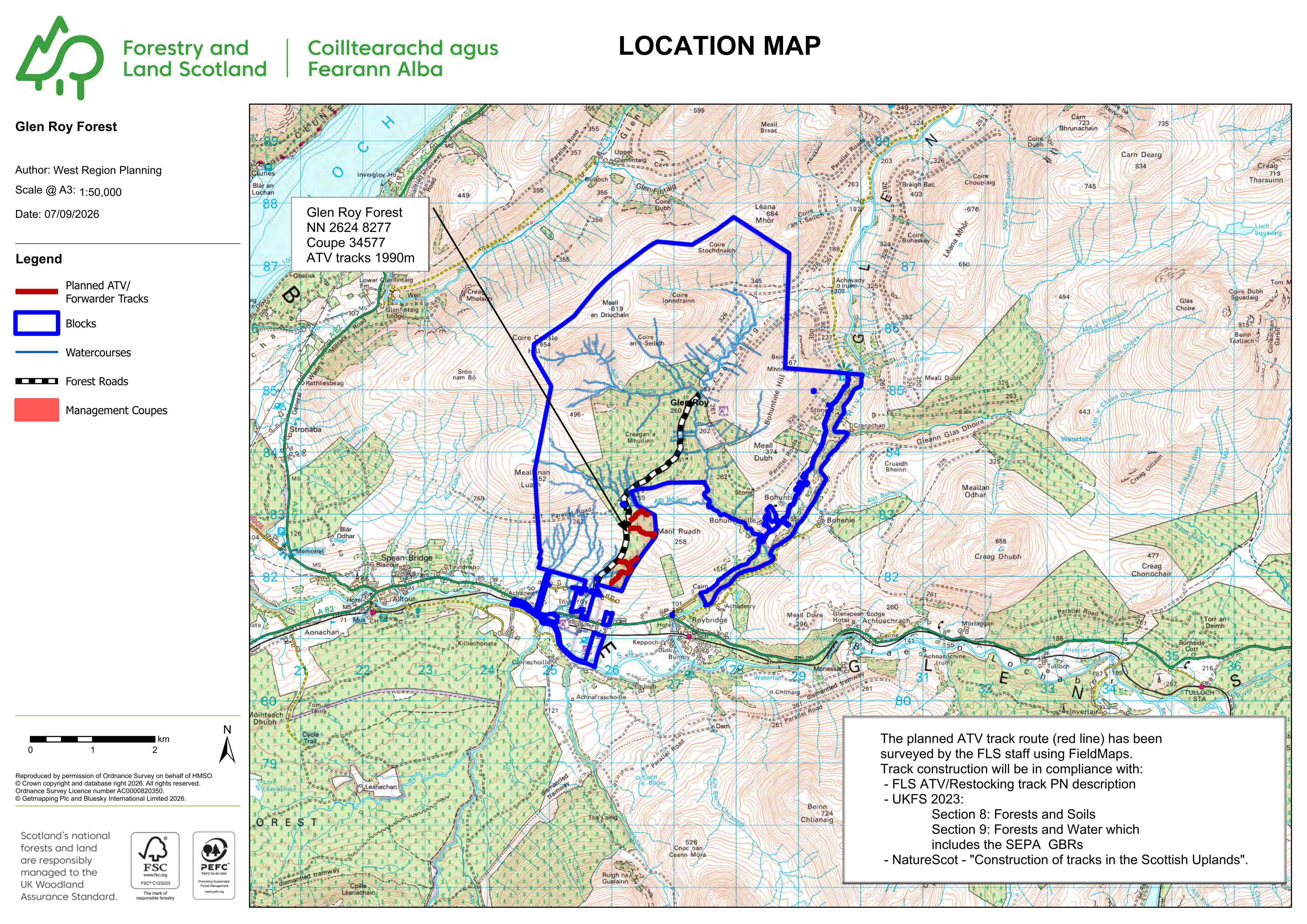
Formation of forest ATV and forwarder tracks, 1990m long and 2.5m wide, for maintenance and deer management.
The record
- Reference
- HLD/26/03906/PNO
- Address
- Land 655M NE Of 12 Upper Inverroy Roy Bridge
- Status
- Under Consideration
- Category
- Landscaping, Gardens & Boundaries
- Impact scale
- 4/10
- Authority
- The Highland Council
Timeline
- Received
- Validated
- Last scraped
- Record created
Additional application data
- Latitude
- 56.8973
- Longitude
- -4.8543
What is proposed
Plain-language summary
Formation of forest ATV and forwarder tracks, 1990m long and 2.5m wide, for maintenance and deer management.
As filed with the council
Formation of forest ATV and forwarder tracks (maintenance and deer management; 1990m long; 2.5m wide)