CityScope · Planning Updates
Application PKC/26/00018/PAA
Land 180 Metres East Of Tigh Na Gleann Cairneyhill Road Bankfoot Perth PH1 4AG
DecidedOutbuildings & Ancillary StructuresReceived Perth and Kinross Council
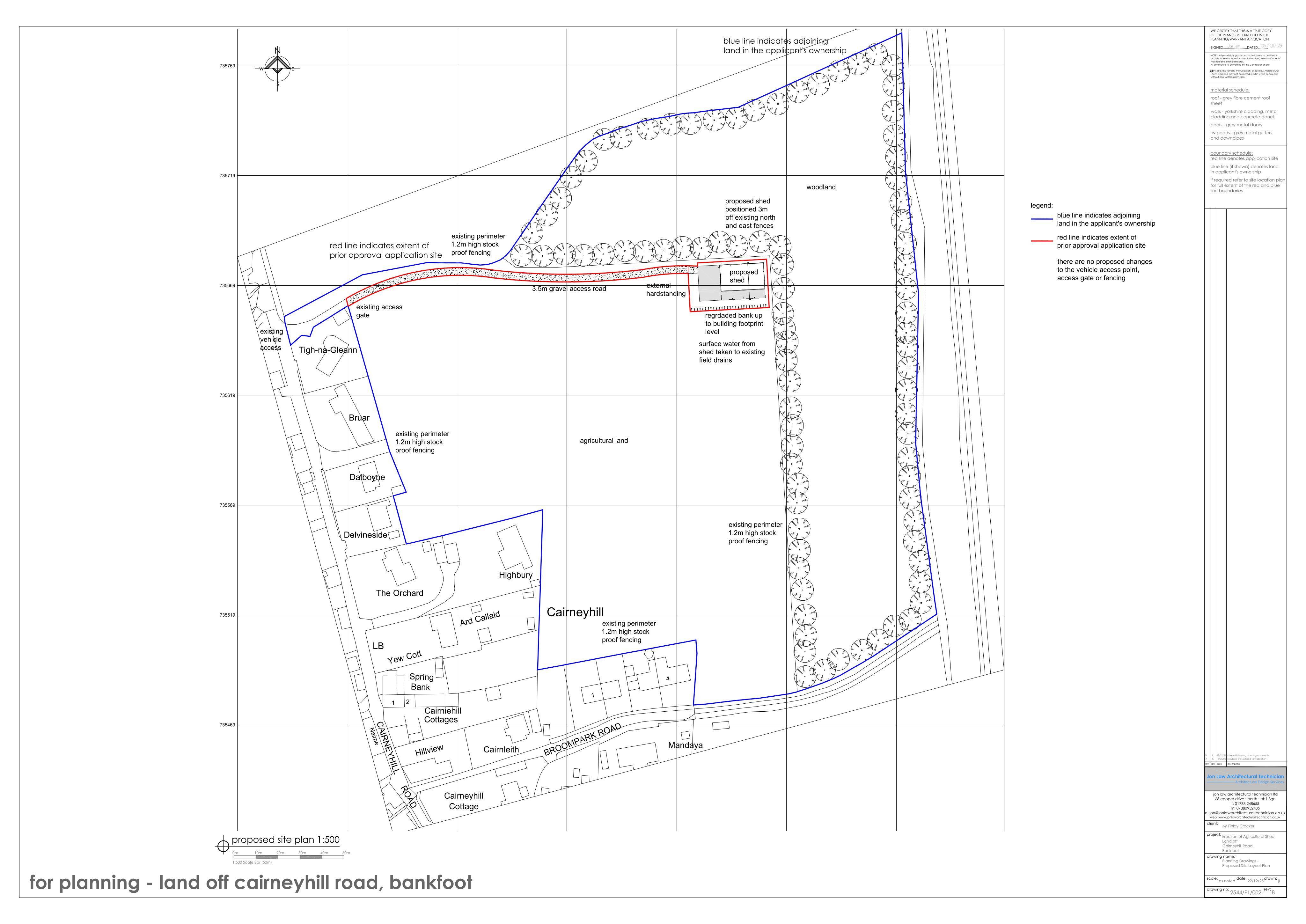
Proposed agricultural shed and new gravel track/access route to the site, with boundary landscaping/trees retained.
The record
- Reference
- PKC/26/00018/PAA
- Address
- Land 180 Metres East Of Tigh Na Gleann Cairneyhill Road Bankfoot Perth PH1 4AG
- Status
- Decided
- Category
- Outbuildings & Ancillary Structures
- Impact scale
- 5/10
- Authority
- Perth and Kinross Council
Timeline
- Received
- Validated
- Last scraped
- Record created
Additional application data
- Latitude
- 56.5037
- Longitude
- -3.5125
What is proposed
Plain-language summary
Proposed agricultural shed and new gravel track/access route to the site, with boundary landscaping/trees retained.
As filed with the council
Erection of an agricultural building and formation of a track