
Planning applicationPKC/26/00817/PNF

Land 220 Metres West Of Woodend Farm Logierait Pitlochry PH9 0LH

Awaiting decisionParking, Access & Highways
Official records · coverage in progress

1,141 of 1,475 official records received 1 Sept 2025 – 31 Aug 2026 were available when checked on 6 Sept 2026. 334 records from that period are still being added or checked.

Proposals and decisions come from Perth and Kinross Council. Additional summaries and analysis are being added where verified.

Check the council’s planning register
Planning document
1 / 3
Received

11 June 2026

Validated

23 June 2026

Planning Signals

3 detected traits

Works
House Extension
Specific
Associated InfrastructureForestry
Application Insights

No form insights available yet.

AI summary

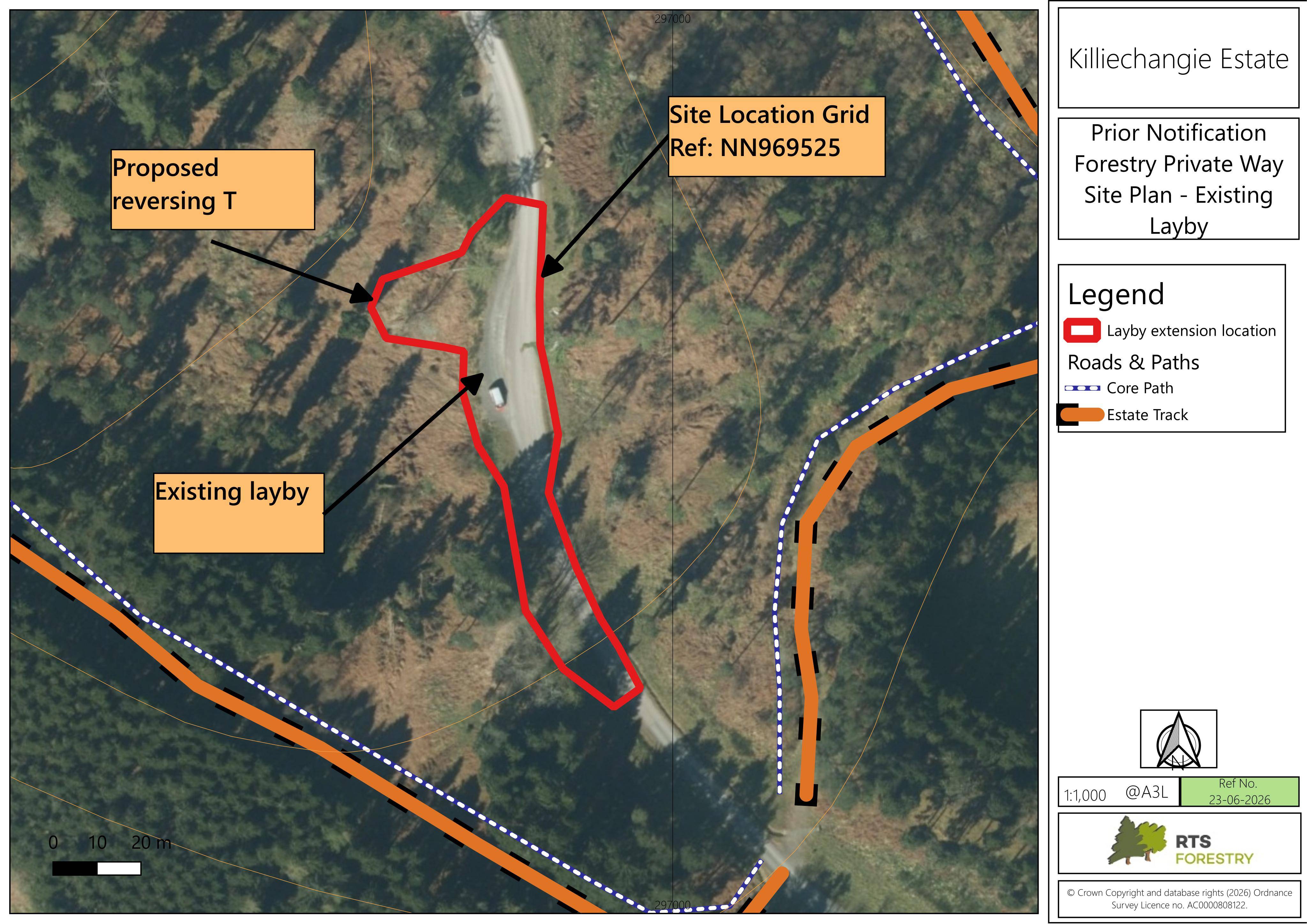
Plans to extend a layby and create a turning head for safer reversing access within the Killiechangaje Estate forestry track network.

Impact scale

Estimated scale of impact on the surrounding area.

4/10
DISCUSSION

No comments yet

Be the first to share your local perspective on this application.

CityScope · Planning Updates

Application PKC/26/00817/PNF

Land 220 Metres West Of Woodend Farm Logierait Pitlochry PH9 0LH

Awaiting decisionParking, Access & HighwaysReceived Perth and Kinross Council

Plans to extend a layby and create a turning head for safer reversing access within the Killiechangaje Estate forestry track network.

Reference
PKC/26/00817/PNF
Address
Land 220 Metres West Of Woodend Farm Logierait Pitlochry PH9 0LH
Status
Awaiting decision
Category
Parking, Access & Highways
Impact scale
4/10
Authority
Perth and Kinross Council
Received
Validated
Last scraped
Record created
Latitude
56.6528
Longitude
-3.6822

Plain-language summary

Plans to extend a layby and create a turning head for safer reversing access within the Killiechangaje Estate forestry track network.

As filed with the council

Extension to layby and formation of turning head