
Planning applicationSBO/25/01792/PN

Catslackburn Forest Land North East Of Mountbengerhope Selkirk Scottish Borders

Awaiting decisionParking, Access & Highways
Official records · analysis in progress

1,291 of 1,291 official records received 1 Sept 2025 – 31 Aug 2026 were available when checked on 6 Sept 2026.

Proposals and decisions come from Scottish Borders Council. Additional summaries and analysis are being added where verified.

Check the council’s planning register
Planning document
1 / 2
Received

4 December 2025

Validated

4 December 2025

Planning Signals

3 detected traits

Specific
ForestryForestry Access TrackPrior Notification
Application Insights

No form insights available yet.

AI summary

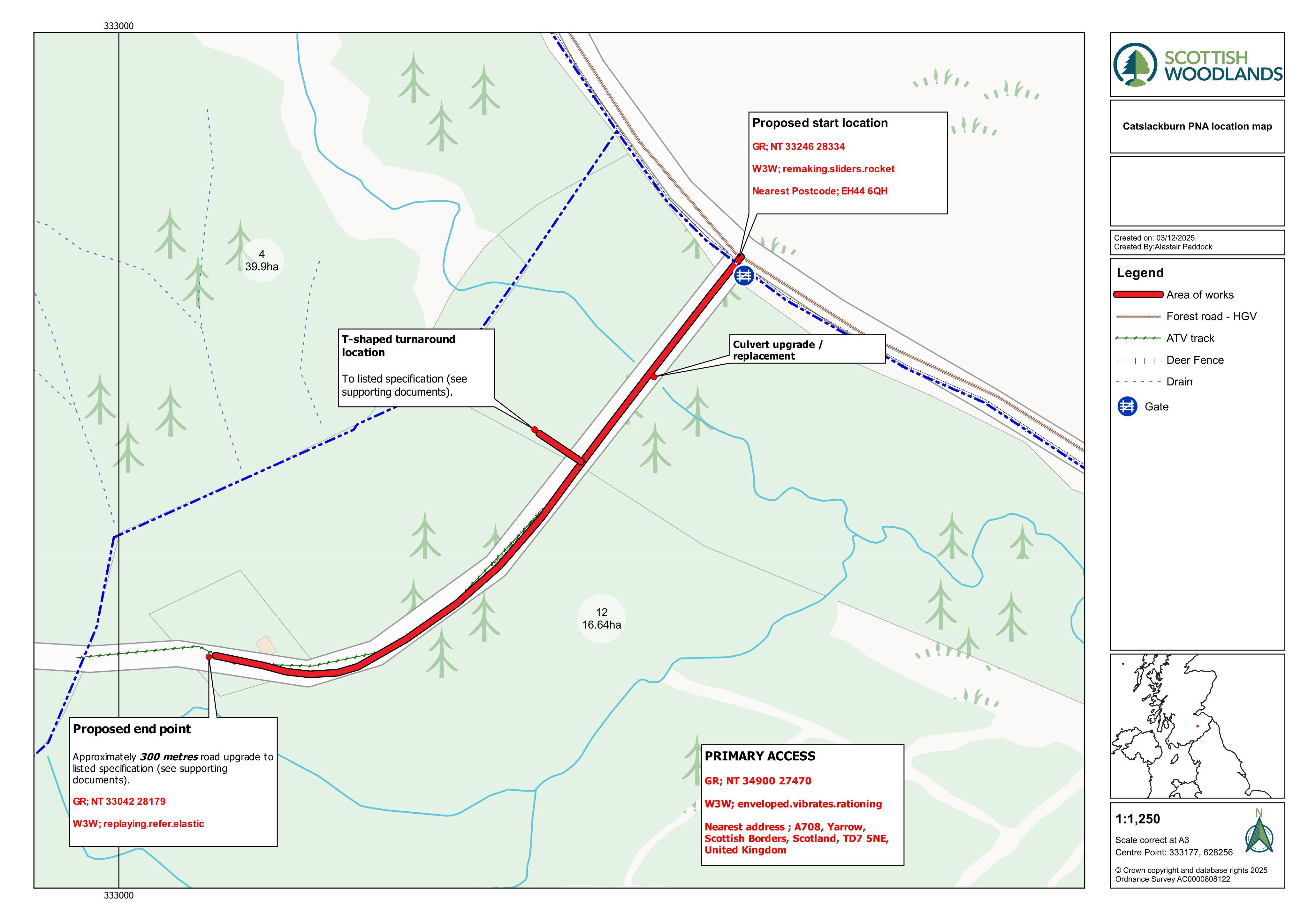
Plans for a new forestry track, including a culvert replacement and upgraded access/turnaround areas to support woodland operations.

Impact scale

Estimated scale of impact on the surrounding area.

4/10
DISCUSSION

No comments yet

Be the first to share your local perspective on this application.

CityScope · Planning Updates

Application SBO/25/01792/PN

Catslackburn Forest Land North East Of Mountbengerhope Selkirk Scottish Borders

Awaiting decisionParking, Access & HighwaysReceived Scottish Borders Council

Plans for a new forestry track, including a culvert replacement and upgraded access/turnaround areas to support woodland operations.

Reference
SBO/25/01792/PN
Address
Catslackburn Forest Land North East Of Mountbengerhope Selkirk Scottish Borders
Status
Awaiting decision
Category
Parking, Access & Highways
Impact scale
4/10
Authority
Scottish Borders Council
Received
Validated
Last scraped
Record created

Plain-language summary

Plans for a new forestry track, including a culvert replacement and upgraded access/turnaround areas to support woodland operations.

As filed with the council

Formation of forestry track