CityScope · Planning Updates
Application SLK/P/25/1223
Land 1500M Nne Of Dryburn Bridge A70 From Carnwath To Boundary By Tarbrax West Calder EH55 8LP
RegisteredNew-Build & Major DevelopmentReceived South Lanarkshire Council
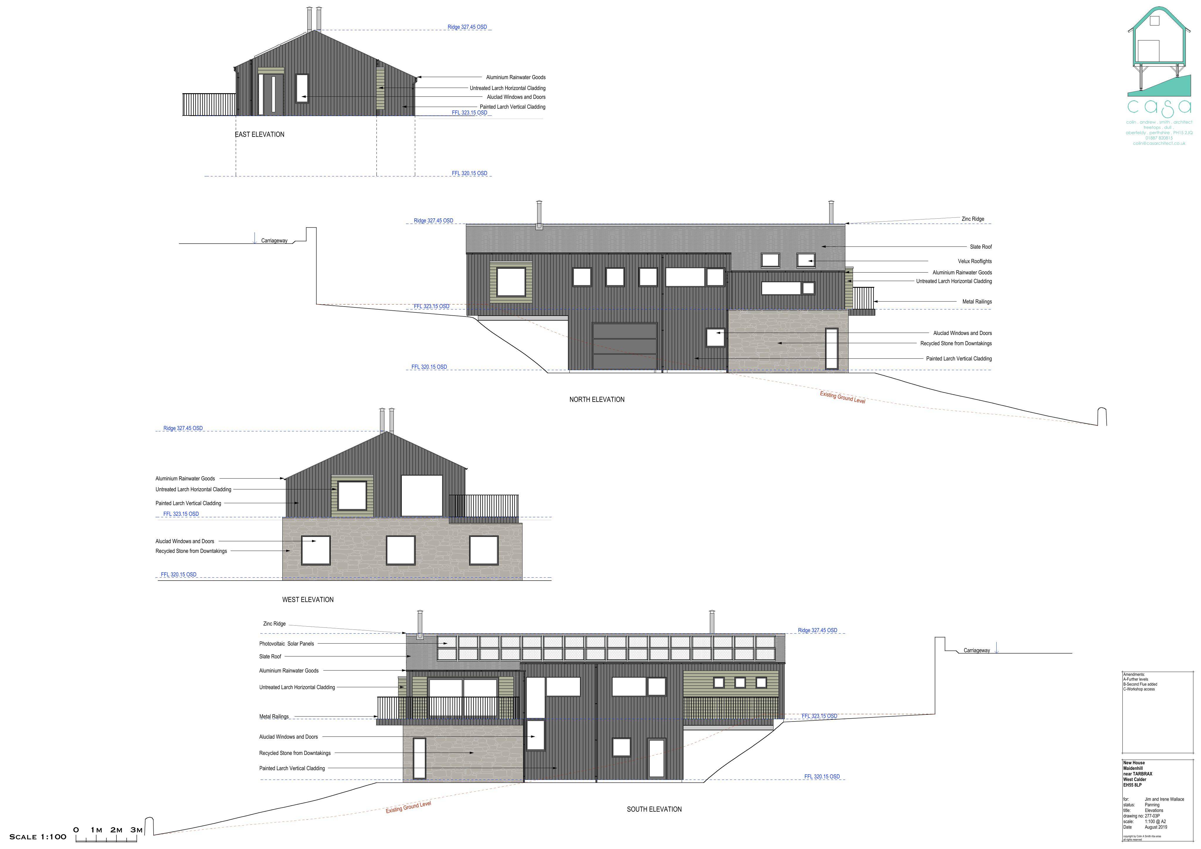
Ruined dwelling to be demolished and a split-level replacement house erected, with a further Reg 11 application for prior consent.
The record
- Reference
- SLK/P/25/1223
- Address
- Land 1500M Nne Of Dryburn Bridge A70 From Carnwath To Boundary By Tarbrax West Calder EH55 8LP
- Status
- Registered
- Category
- New-Build & Major Development
- Impact scale
- 6/10
- Authority
- South Lanarkshire Council
Timeline
- Received
- Validated
- Last scraped
- Record created
Additional application data
- Latitude
- 55.7833
- Longitude
- -3.5297
What is proposed
Plain-language summary
Ruined dwelling to be demolished and a split-level replacement house erected, with a further Reg 11 application for prior consent.
As filed with the council
Demolition of ruined dwelling and erection of split level dwelling house (Further application under Regulation 11 to consent P/22/1418)