
CityScope · Planning Updates
Application STG/25/00698/FUL
Land North Of Wallace High School Airthrey Road Stirling
DecidedParking, Access & HighwaysReceived Stirling Council
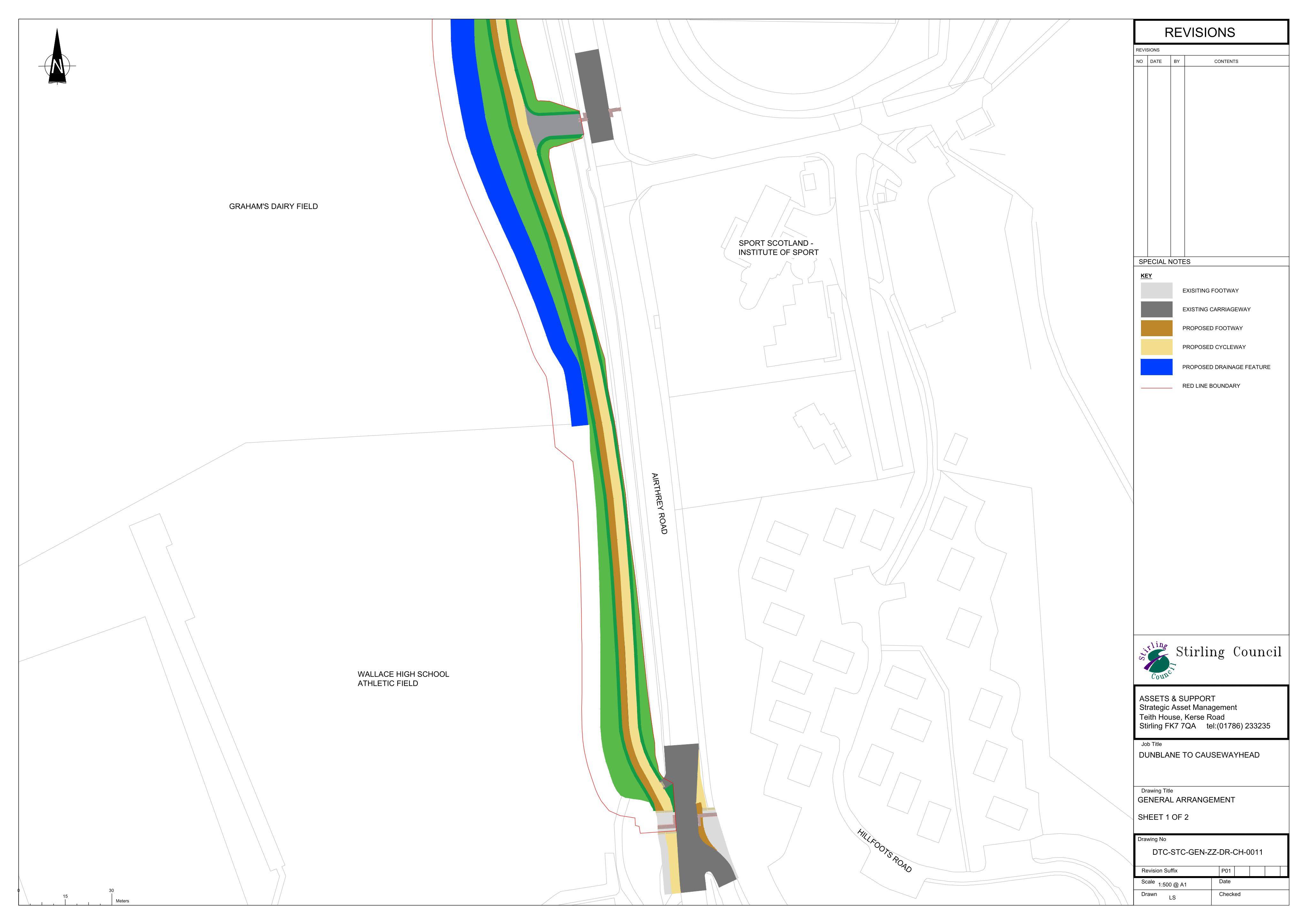
Proposed off-road footway and cycleway along Airthrey Road, with earthworks, drainage, surfacing, lighting/signage and boundary landscaping integration.
The record
- Reference
- STG/25/00698/FUL
- Address
- Land North Of Wallace High School Airthrey Road Stirling
- Status
- Decided
- Category
- Parking, Access & Highways
- Impact scale
- 5/10
- Authority
- Stirling Council
Timeline
- Received
- Validated
- Last scraped
- Record created
Additional application data
- Latitude
- 56.1432
- Longitude
- -3.9273
What is proposed
Plain-language summary
Proposed off-road footway and cycleway along Airthrey Road, with earthworks, drainage, surfacing, lighting/signage and boundary landscaping integration.
As filed with the council
Change of use of land to form a new off-road footway and cycleway with works including earthworks, surfacing, drainage, signage, landscaping, and boundary treatments to integrate with surrounding land uses