
CityScope · Planning Updates
Application STG/25/00703/MSC
Land North East Of Pirnhall And South West Of Bannockburn Bannockburn
Awaiting decisionParking, Access & HighwaysReceived Stirling Council
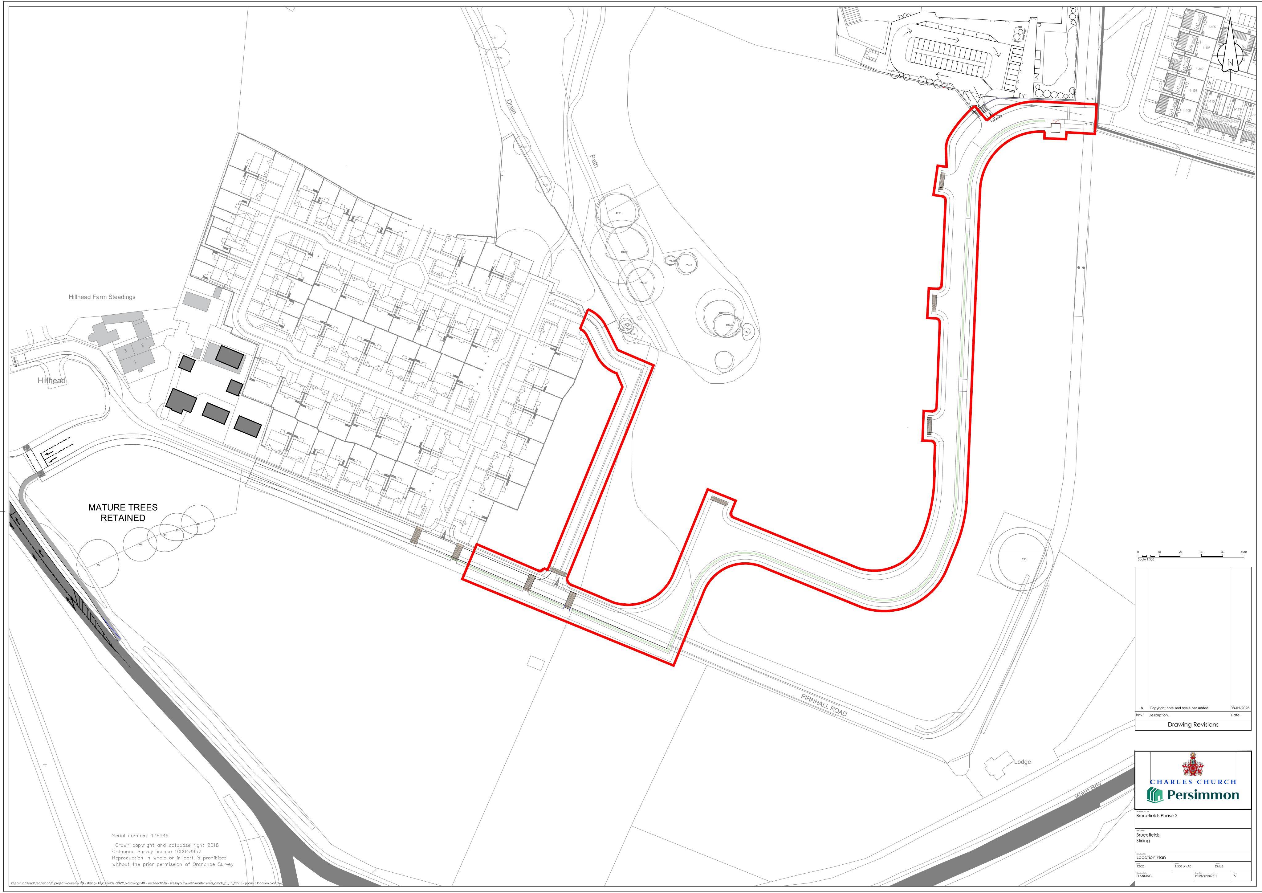
Plans for a new spine road linking Pirnhall Road with South Stirling Gateway, shaping the road layout for the new primary school area.
The record
- Reference
- STG/25/00703/MSC
- Address
- Land North East Of Pirnhall And South West Of Bannockburn Bannockburn
- Status
- Awaiting decision
- Category
- Parking, Access & Highways
- Impact scale
- 6/10
- Authority
- Stirling Council
Timeline
- Received
- Validated
- Last scraped
- Record created
Additional application data
- Latitude
- 56.091722
- Longitude
- -3.908402
What is proposed
Plain-language summary
Plans for a new spine road linking Pirnhall Road with South Stirling Gateway, shaping the road layout for the new primary school area.
As filed with the council
Approval of Matters Specified in Conditions 1 of Planning Permission 18/00850/PPP for the construction of a new spine road on land between the south of Pirnhall Road (adjacent to Phases 3(a) and (b) and the new primary school at South Stirling Gateway