
CityScope · Planning Updates
Application STG/26/00075/NAG
Kiltane Dunblane FK15 0HT
UnknownParking, Access & HighwaysReceived Stirling Council
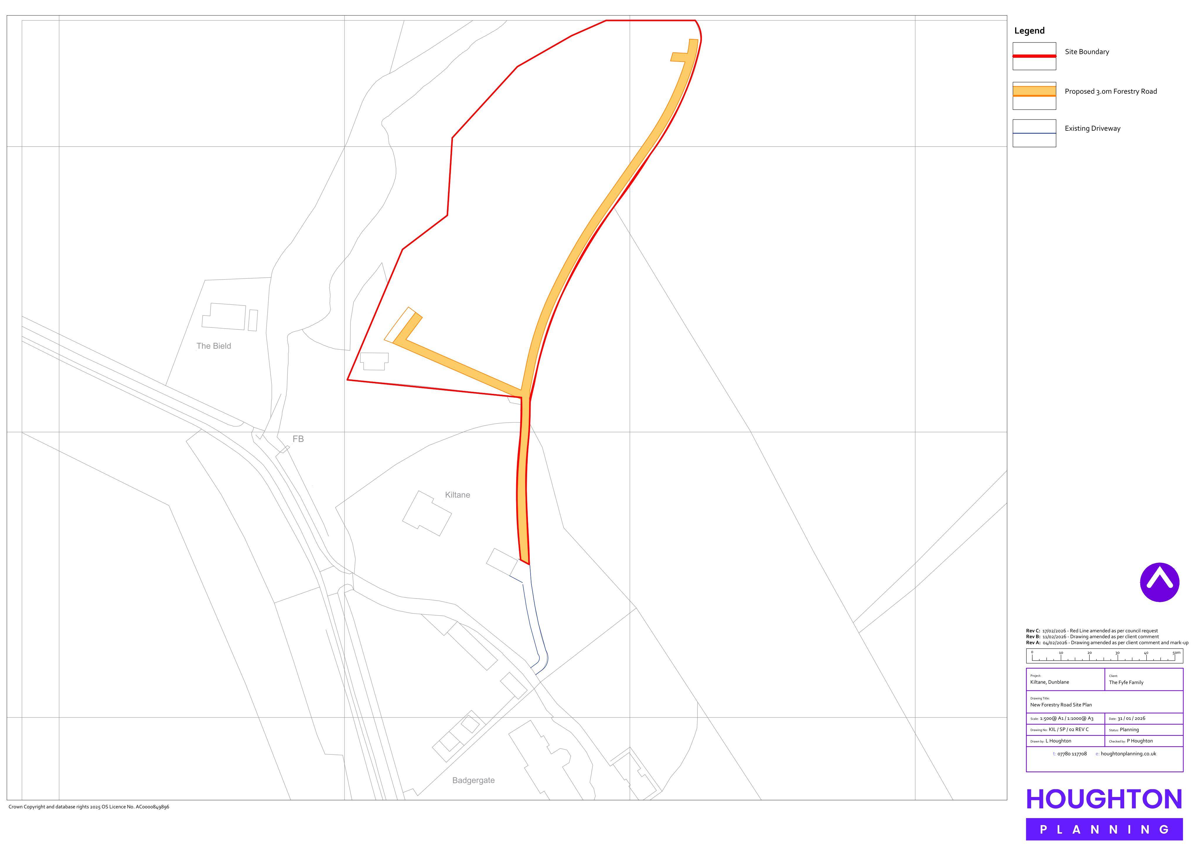
Proposed 3m forestry road at Kiltane, Dunblane, to form a new private access route linking into the existing track/driveway.
The record
- Reference
- STG/26/00075/NAG
- Address
- Kiltane Dunblane FK15 0HT
- Status
- Unknown
- Council decision
- Prior Approval Not Required
- Decision issued
- Category
- Parking, Access & Highways
- Impact scale
- 4/10
- Authority
- Stirling Council
Timeline
- Received
- Validated
- Last scraped
- Record created
Additional application data
- Latitude
- 56.1781
- Longitude
- -3.9365
What is proposed
Plain-language summary
Proposed 3m forestry road at Kiltane, Dunblane, to form a new private access route linking into the existing track/driveway.
As filed with the council
Formation of forest road