
CityScope · Planning Updates
Application STG/26/00240/NAG
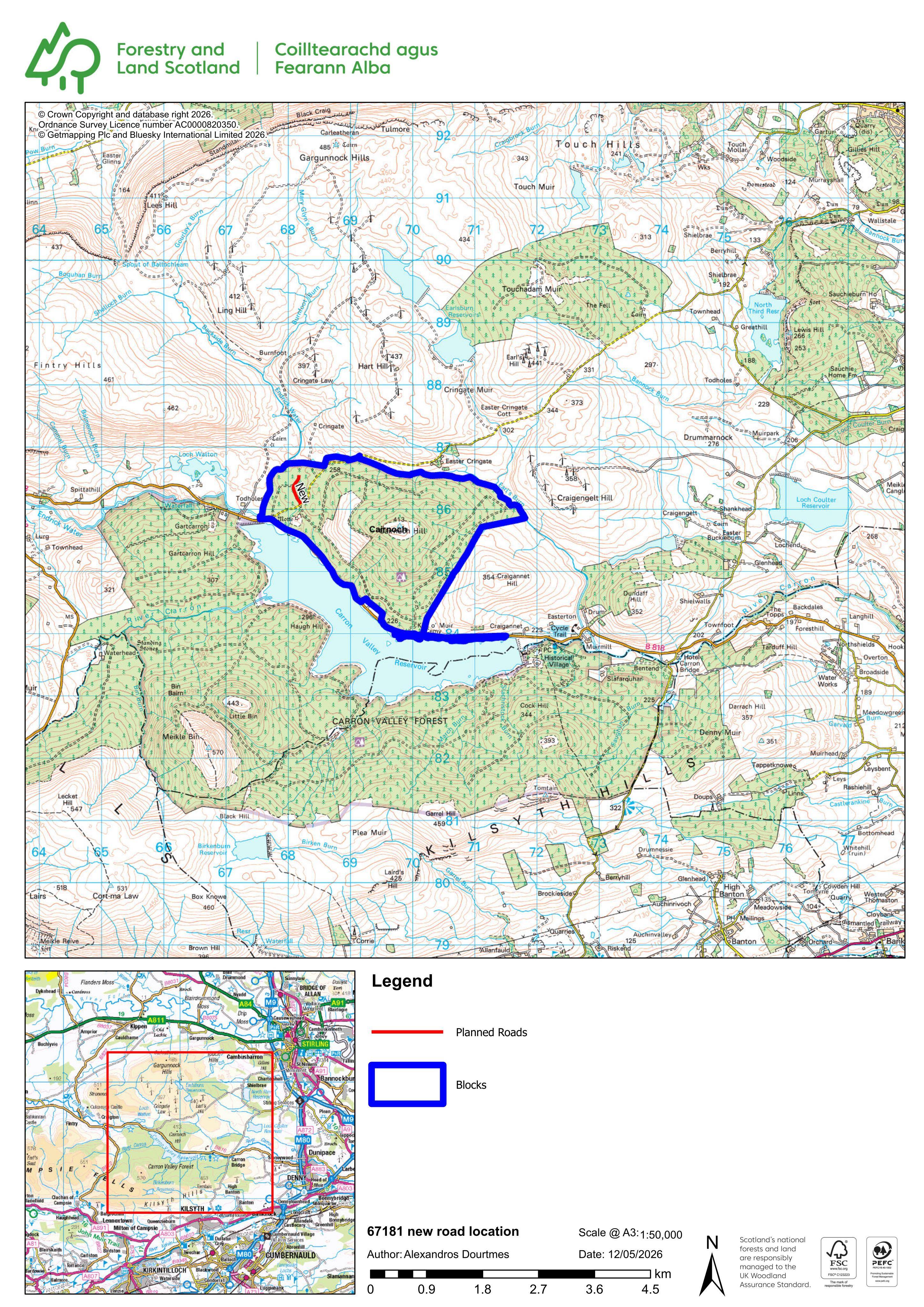
Land 900M East Of Todholes Farm Denny Road Fintry
UnknownParking, Access & HighwaysReceived Stirling Council
New forest road for timber haulage access, including works to an existing haul route.
The record
- Reference
- STG/26/00240/NAG
- Address
- Land 900M East Of Todholes Farm Denny Road Fintry
- Status
- Unknown
- Council decision
- Prior Approval Not Required
- Decision issued
- Category
- Parking, Access & Highways
- Impact scale
- 5/10
- Authority
- Stirling Council
Timeline
- Received
- Validated
- Last scraped
- Record created
Additional application data
- Latitude
- 56.05282399999999
- Longitude
- -4.22064
What is proposed
Plain-language summary
New forest road for timber haulage access, including works to an existing haul route.
As filed with the council
Creation of new forest road to provide operational access for timber haulage