CityScope · Planning Updates
Application EDI/26/02211/FUL
Land 130 Metres South Of 12 Lasswade Grove Edinburgh
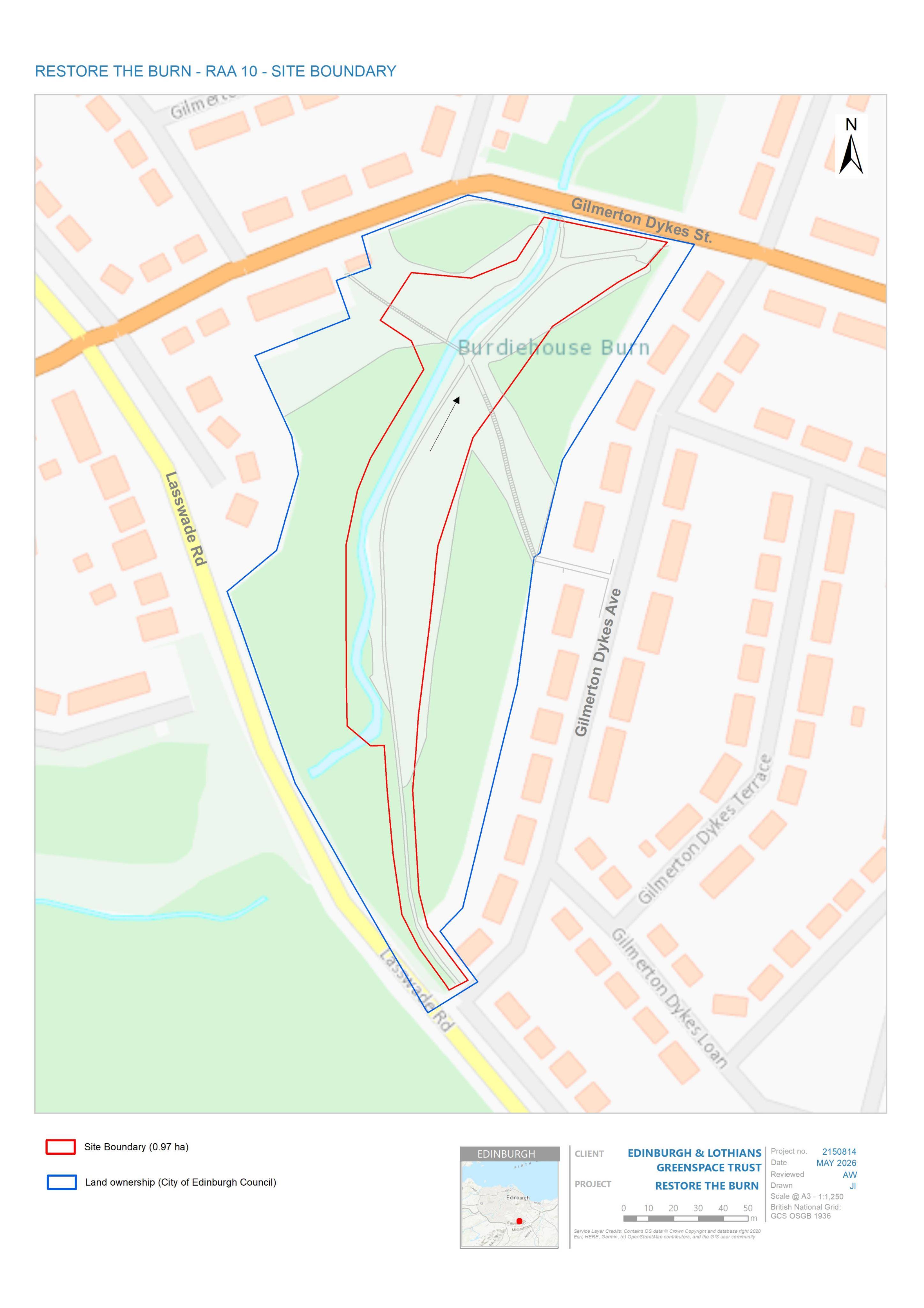
Burn restoration could re-meander the channel, reconnect the floodplain, move the path, replace the bridge and add north-bank seating.
The record
- Reference
- EDI/26/02211/FUL
- Address
- Land 130 Metres South Of 12 Lasswade Grove Edinburgh
- Status
- Awaiting Assessment
- Category
- Trees, Ecology & Green Space
- Impact scale
- 6/10
- Authority
- The City of Edinburgh Council
Timeline
- Received
- Validated
- Last scraped
- Record created
Additional application data
- Latitude
- 55.903
- Longitude
- -3.1466
What is proposed
Plain-language summary
Burn restoration could re-meander the channel, reconnect the floodplain, move the path, replace the bridge and add north-bank seating.
As filed with the council
Proposals for the burn include re-meandering of the river channel along with associated channel reprofiling and floodplain re-connection. Proposals for the surrounding landscape include diversification of existing habitats, setting the existing path back away from the burn, replacement of the existing bridge, and new amphitheatre seating on the north bank.
Supporting documents(4)
City Scope Journal
Burdiehouse Burn restoration proposed south of Lasswade Grove
Plans for land south of Lasswade Grove would reshape part of Burdiehouse Burn, reconnect its floodplain, move a path back from the water, replace a bridge and add amphitheatre-style seating on the north bank.
Read the Journal article →