
CityScope · Planning Updates
Application DGY/25/1719/FUL
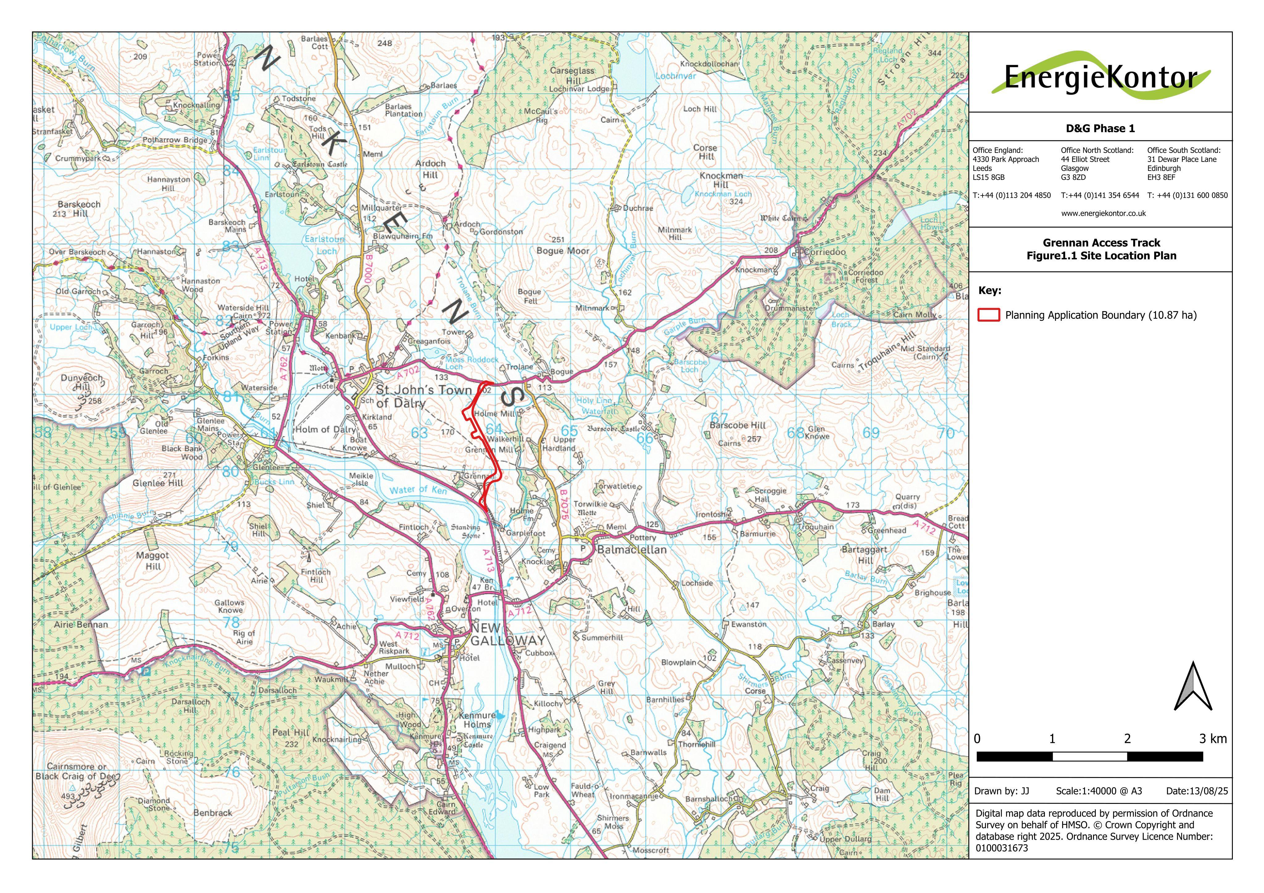
Land To The East And South-east Of St John's Town Of Dalry Castle Douglas
New junction accesses off A713/A702 plus about 1.9km access track with cut-and-fill to support abnormal wind turbine deliveries for Margree and others.
The record
- Reference
- DGY/25/1719/FUL
- Address
- Land To The East And South-east Of St John's Town Of Dalry Castle Douglas
- Status
- Decided
- Category
- Parking, Access & Highways
- Impact scale
- 7/10
- Authority
- Dumfries and Galloway Council
Timeline
- Received
- Validated
- Last scraped
- Record created
Additional application data
- Latitude
- 55.097
- Longitude
- -4.1341
What is proposed
Plain-language summary
New junction accesses off A713/A702 plus about 1.9km access track with cut-and-fill to support abnormal wind turbine deliveries for Margree and others.
As filed with the council
FORMATION OF 2 NEW ACCESSES ONTO A713 AND A702 PUBLIC ROAD AND FORMATION OF 1.9KM OF ACCESS TRACK (INCLUDING ASSOCIATED CUT AND FILL ENGINEERING OPERATIONS) TO PROVIDE ALTERNATIVE ROUTE TO ACCOMMODATE ABNORMALLY LARGE WIND FARM COMPONENT LOADS ASSOCIATED WITH PROPOSED MARGREE WIND FARM AND OTHER WINDFARM DEVELOPMENT IN THE AREA