CityScope · Planning Updates
Application HLD/25/03509/SCOP
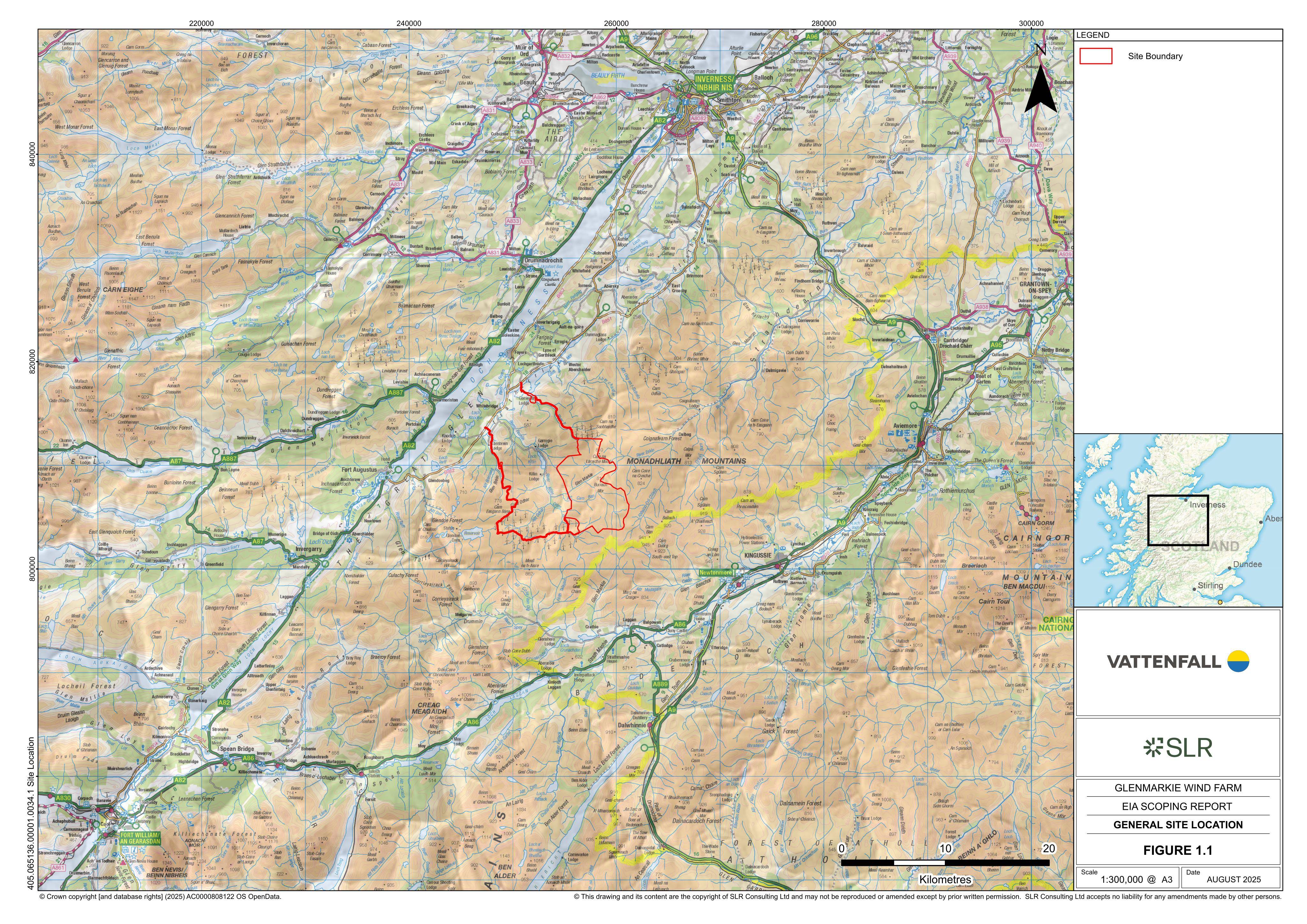
Land 5KM East Of Killin Lodge Whitebridge Inverness
Under ConsiderationRenewable Energy, EV & Heat PumpsReceived The Highland Council
Plans for Glenmarkie wind farm: up to 65 turbines (up to 250m tip height) with access roads and grid infrastructure.
The record
- Reference
- HLD/25/03509/SCOP
- Address
- Land 5KM East Of Killin Lodge Whitebridge Inverness
- Status
- Under Consideration
- Category
- Renewable Energy, EV & Heat Pumps
- Impact scale
- 9/10
- Authority
- The Highland Council
Timeline
- Received
- Validated
- Last scraped
- Record created
Additional application data
- Latitude
- 57.1621
- Longitude
- -4.3655
What is proposed
Plain-language summary
Plans for Glenmarkie wind farm: up to 65 turbines (up to 250m tip height) with access roads and grid infrastructure.
As filed with the council
Glenmarkie Wind Farm - Construction and operation of a wind farm comprising up to 65 wind turbines, with a tip height of up to 250 m, and associated works and infrastructure