CityScope · Planning Updates
Application PKC/25/01477/FLL
Land 5.7km North Of Rynachulaig Farmhouse Killin FK21 8TY
DecidedPublic Realm & Community ProjectsReceived Perth and Kinross Council
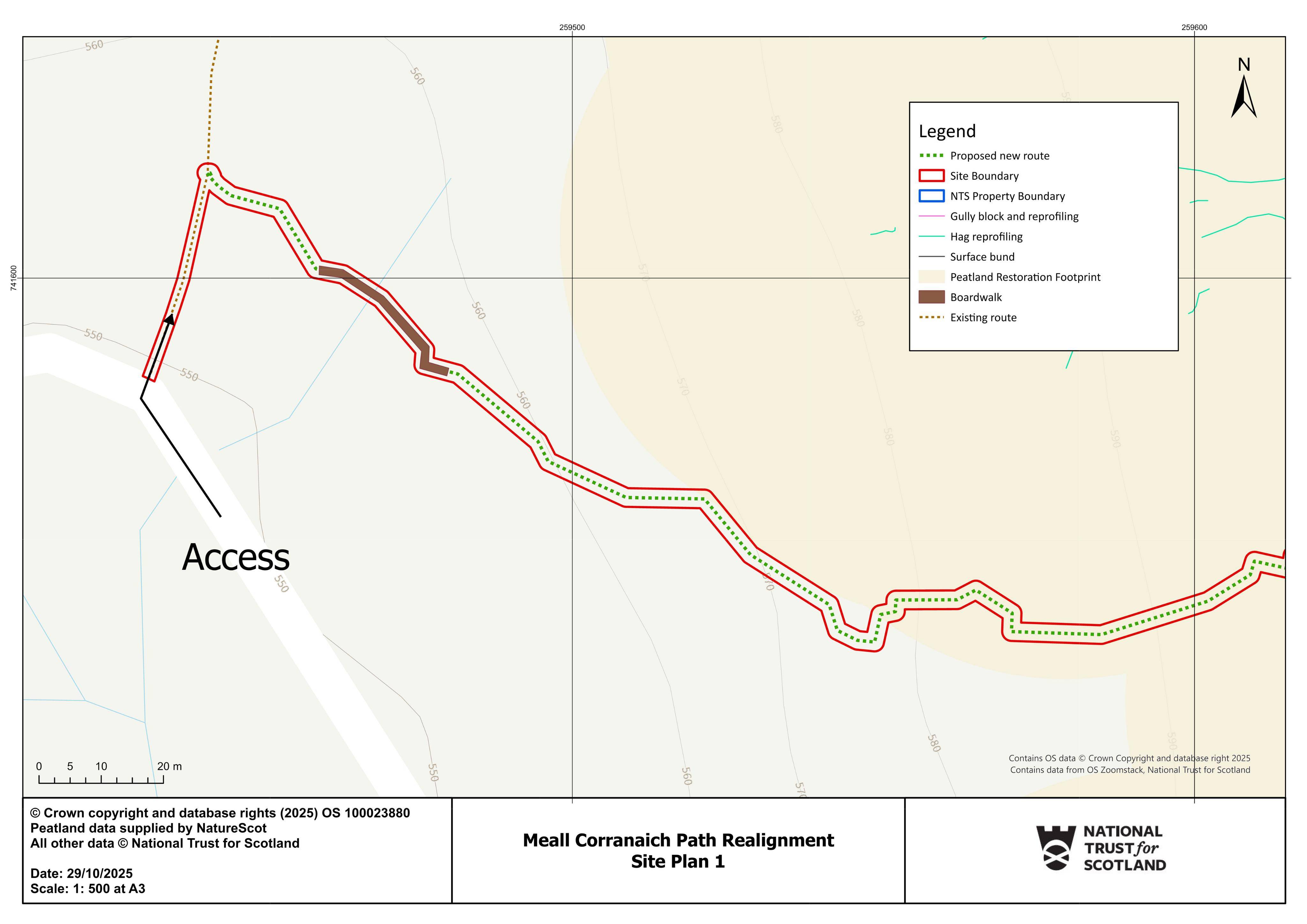
New/realigned footpath shown for the Meall Corranaich area, including route changes across open ground to improve access.
The record
- Reference
- PKC/25/01477/FLL
- Address
- Land 5.7km North Of Rynachulaig Farmhouse Killin FK21 8TY
- Status
- Decided
- Category
- Public Realm & Community Projects
- Impact scale
- 4/10
- Authority
- Perth and Kinross Council
Timeline
- Received
- Validated
- Last scraped
- Record created
Additional application data
- Latitude
- 56.497165
- Longitude
- -4.244527
What is proposed
Plain-language summary
New/realigned footpath shown for the Meall Corranaich area, including route changes across open ground to improve access.
As filed with the council
Formation of footpath